Gopalganj (district)
Contenu soumis à la licence CC-BY-SA. Source : Article Gopalganj (district) de Wikipédia en français (auteurs)
Regardez d'autres dictionnaires:
Gopalganj District — may refer to: * Gopalganj District (Bangladesh) * Gopalganj District, India … Wikipedia
Gopalganj District — Admin ASC 2 Code Orig. name Gopālganj District Country and Admin Code BD.81.17 BD … World countries Adminstrative division ASC I-II
Gopalganj district, India — Gopalganj is an administrative district in the state of Bihar in India. The district headquarters are located in the town of Gopalganj, and the district is a part of Saran Division.The district occupies an area of 2033 km² and has a population of … Wikipedia
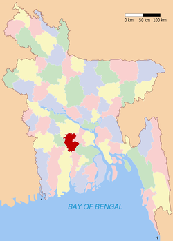
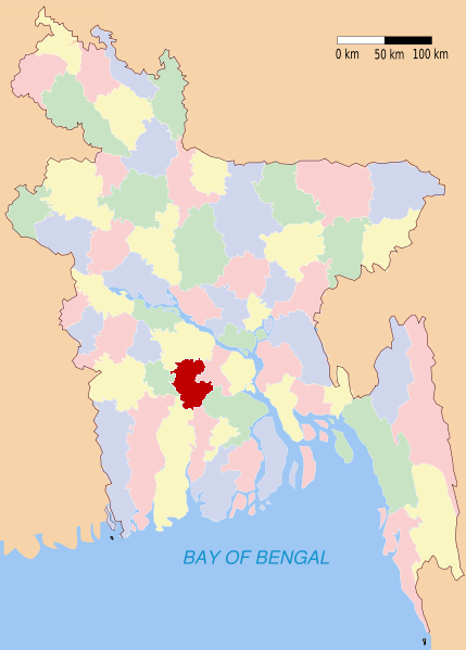
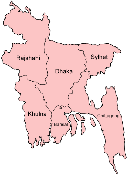
Gopalganj District (Bangladesh) — Infobox of BD districts native name = Gopalganj skyline = skyline size = skyline caption = locator position = right latd = 23.20 longd = 89.80 division name = Dhaka Division population as of = 1991 population total = 1,132,046 population density … Wikipedia
Gopalganj District — noun One of the seventeen districts in the Dhaka Division of Bangladesh … Wiktionary
Gopalganj — may refer to: *Gopalganj District, Bangladesh *Gopalganj, Bangladesh *Gopalganj District, India *Gopalganj, India … Wikipedia
Gopalganj (zila) — Capital Gopalganj Entidad Zi … Wikipedia Español
Gopalganj Sadar Upazila — Infobox of upazilas native name = Gopalganj Sadar locator position = right latd = 23.0167 longd = 89.8333 division name = Dhaka Division district = Gopalganj District population as of = 1991 population total = 291409 population density = 745 area … Wikipedia
Gopalganj, India — Infobox Indian Jurisdiction native name = Gopalganj | type = city | latd = 26.47 | longd = 84.43 locator position = right | state name = Bihar district = Gopalganj leader title = leader name = altitude = 66 population as of = 2001 population… … Wikipedia
Saran district — सारन जिला Location of Saran district in Bihar State … Wikipedia