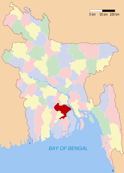
Barisal (district)
- Barisal (district)
-
Wikimedia Foundation.
2010.
Contenu soumis à la licence CC-BY-SA. Source : Article Barisal (district) de Wikipédia en français (auteurs)
Regardez d'autres dictionnaires:
Barisal District — Infobox of BD districts native name = Barisal skyline = Barisal Town Hall.jpg skyline size = skyline caption = Barisal Town Hall locator position = right latd = 22.8000 longd = 90.3667 division name = Barisal Division population as of = 1991… … Wikipedia
Barisal District — Admin ASC 2 Code Orig. name Barisāl District Country and Admin Code BD.85.06 BD … World countries Adminstrative division ASC I-II
Barisal District — noun One of the six districts in the Barisal Division of Bangladesh … Wiktionary
Bagra, Barisal District — Infobox Settlement official name = Bagra other name = native name = nickname = settlement type = motto = imagesize = image caption = flag size = image seal size = image shield = shield size = image blank emblem = blank emblem type = blank emblem… … Wikipedia
Barisal — বরিশাল Administration Pays Bangladesh … Wikipédia en Français
Barisal City — Infobox city official name = Barisal nickname = Chandradvipa image map caption = Location of Barisal in Bangladesh subdivision type = Country subdivision type1 = Administrative District subdivision name = Bangladesh subdivision name1 = Barisal… … Wikipedia
Barisal Sadar Upazila — Infobox of upazilas native name = Barisal Sadar locator position = right latd = 22.7000 longd = 90.3667 division name = Barisal Division district = Barisal District population as of = 1991 population total = 414281 population density = 1347 area… … Wikipedia
Barisal Conspiracy Case — The Barisal Conspiracy Case of 1913 was a trial prosecuted by the British colonial authorities against 44 Bengalis who were accused of planning to incite rebellion against the Raj. As such, it was part of the greater movement for independence… … Wikipedia
Barisal Division — Barisāl (also spelt Barisal) is located in south central Bangladesh. Formerly a district called Bakerganj, it is now one of the 6 divisions of Bangladesh. The town lies in the Ganges (Padma) River delta on an offshoot of the Arial Khan River… … Wikipedia
Barisal (division) — 22°30′N 90°20′E / 22.5, 90.333 … Wikipédia en Français


