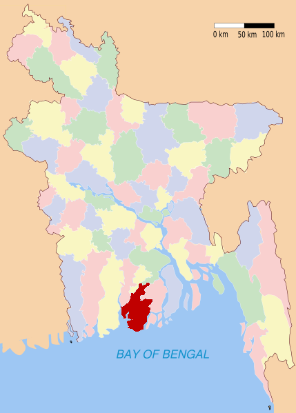
Barguna (district)
- Barguna (district)
-
Wikimedia Foundation.
2010.
Contenu soumis à la licence CC-BY-SA. Source : Article Barguna (district) de Wikipédia en français (auteurs)
Regardez d'autres dictionnaires:
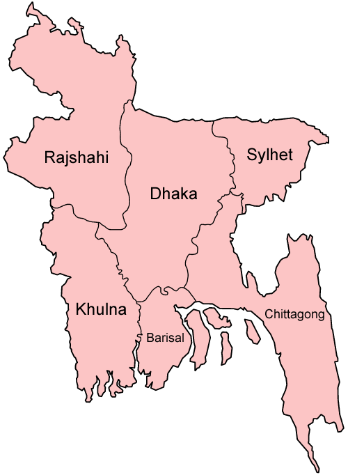
Barguna District — Infobox of BD districts native name = Barguna skyline = skyline size = skyline caption = locator position = left latd = 22.1508 longd = 90.1264 division name = Barisal Division area total = 1831.31 temperature = 12.1°C 33.3°C population as of =… … Wikipedia
Barguna District — Admin ASC 2 Code Orig. name Barguna District Country and Admin Code BD.85.02 BD … World countries Adminstrative division ASC I-II
Barguna District — noun One of the six districts in the Barisal Division of Bangladesh … Wiktionary
Barguna Sadar Upazila — Infobox of upazilas native name = Barguna Sadar locator position = right latd = 22.1508 longd = 90.1264 division name = Barisal Division district = Barguna District population as of = 1991 population total = 219729 population density = 484 area… … Wikipedia
Gazipur, Barguna — Infobox Settlement official name = Gazipur, Barguna other name = native name = nickname = settlement type = motto = imagesize = image caption = flag size = image seal size = image shield = shield size = image blank emblem = blank emblem type =… … Wikipedia
Marichbania, Barguna — Marichbania … Wikipedia
Adabaria, Barguna — Infobox Settlement official name = Adabaria other name = native name = nickname = settlement type = motto = imagesize = image caption = flag size = image seal size = image shield = shield size = image blank emblem = blank emblem type = blank… … Wikipedia
Bagerhat District — Infobox of BD districts native name = Bagerhat skyline = Bagerhat (Mosque City).jpg skyline size = skyline caption = The historic 60 dome mosque (ষাট গম্বুজ মসজিদ) has become the symbol of Bagerhat District locator position = right latd = 22.66… … Wikipedia
Natore District — Natore District Uttara Gano Bhaban, earlier known as Natore Rajbadi, is n … Wikipedia
Mymensingh District — Mymensingh ময়মনসিংহ District Office of the District Commissioner of Mymensingh … Wikipedia