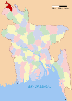
Panchagarh (district)
Contenu soumis à la licence CC-BY-SA. Source : Article Panchagarh (district) de Wikipédia en français (auteurs)
Regardez d'autres dictionnaires:
Panchagarh District — Admin ASC 2 Code Orig. name Panchāgarh District Country and Admin Code BD.87.1337153 BD … World countries Adminstrative division ASC I-II
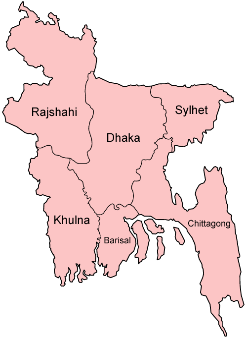
Panchagarh District — Infobox of BD districts native name = Panchagarh skyline = skyline size = skyline caption = locator position = right latd = 26.25 longd = 88.50 division name = Rajshahi Division population as of = 1991 population total = 829,374 population… … Wikipedia
Panchagarh District — noun One of the eight districts in the Rangpur Division of Bangladesh … Wiktionary
Panchagarh Sadar Upazila — Infobox of upazilas native name = Panchagarh Sadar locator position = right latd = 26.3347 longd = 88.5583 division name = Rajshahi Division district = Panchagarh District population as of = 1991 population total = 193198 population density = 557 … Wikipedia
Thakurgaon District — Infobox of BD districts native name = Thakurgaon skyline = skyline size = skyline caption = locator position = right latd = 25.95 longd = 88.25 division name = Rajshahi Division population as of = 1991 population total = 1,196,429 population… … Wikipedia
Dinajpur District (Bangladesh) — Dinajpur দিনাজপুর District Location of Dinajpur in Bangladesh … Wikipedia
Dinajpur District, Bangladesh — Infobox of BD districts native name = Dinajpur skyline = skyline size = skyline caption = locator position = right latd = 25.63 longd = 88.65 division name = Rajshahi Division population as of = 1991 population total = 2,617,942 population… … Wikipedia
Nilphamari District — Nilphamari District Location of Nilphamari in Bangladesh … Wikipedia
Chuadanga District — Chuadanga চুয়াডাঙা District Location of Chuadanga in Bangladesh … Wikipedia
Nawabganj District — Chapai Nawabganj চাঁপাই নওয়াবগঞ্জ District Coordinates … Wikipedia