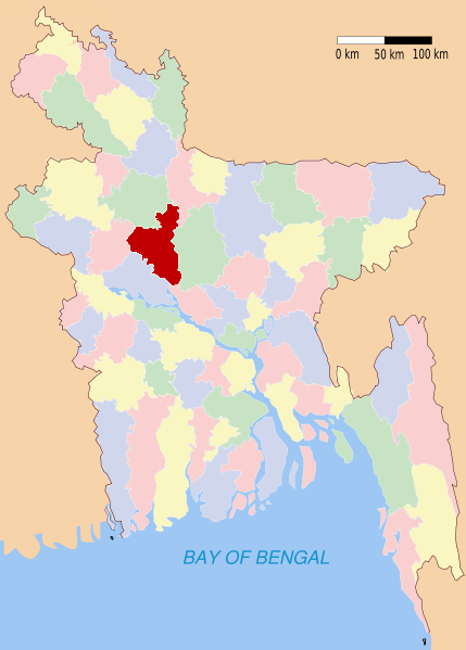
Sirajganj (district)
Contenu soumis à la licence CC-BY-SA. Source : Article Sirajganj (district) de Wikipédia en français (auteurs)
Regardez d'autres dictionnaires:
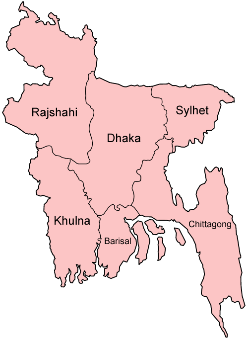
Sirajganj District — Infobox of BD districts native name = Sirajganj skyline = skyline size = skyline caption = locator position = right latd = 24.33 longd = 89.62 division name = Rajshahi Division population as of = 1991 population total = 2,707,011 population… … Wikipedia
Sirajganj District — Admin ASC 2 Code Orig. name Sirājganj District Country and Admin Code BD.83.59 BD … World countries Adminstrative division ASC I-II
Sirajganj District — noun One of the eight districts in the Rajshahi Division of Bangladesh … Wiktionary
Sirajganj — is a town in central Bangladesh, lying just west of the Brahmaputra River and about 70 mi. (110 km) northwest of Dhaka. Overview It is the main town in Sirajganj District. It consists of 15 wards and 52 mohallas. The town has a population of… … Wikipedia
Sirajganj (zila) — Sirajganj সিরাজগঞ্জ Zila (distrito) de Bangladés … Wikipedia Español
Sirajganj Sadar Upazila — Infobox of upazilas native name = Sirajganj Sadar(Shirajgonj Shodor) locator position = right latd = 24.4583 longd = 89.7000 division name = Rajshahi Division district = Sirajganj District population as of = 1991 population total = 389160… … Wikipedia
Pabna District — Pabna পাবনা জেলা District Location of Pabna in Bangladesh … Wikipedia
Tangail District — Infobox of BD districts native name = Tangail skyline = Entrance of Tangail.jpg skyline size = skyline caption = Entrance to Tangail locator position = right latd = 24.30 longd = 89.92 division name = Dhaka Division population as of = 1991… … Wikipedia
Nawabganj District — Chapai Nawabganj চাঁপাই নওয়াবগঞ্জ District Coordinates … Wikipedia
Natore District — Natore District Uttara Gano Bhaban, earlier known as Natore Rajbadi, is n … Wikipedia