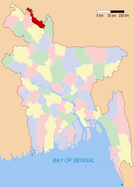
Lalmonirhat (district)
Contenu soumis à la licence CC-BY-SA. Source : Article Lalmonirhat (district) de Wikipédia en français (auteurs)
Regardez d'autres dictionnaires:
Lalmonirhat District — Admin ASC 2 Code Orig. name Lālmonirhāt District Country and Admin Code BD.87.32 BD … World countries Adminstrative division ASC I-II
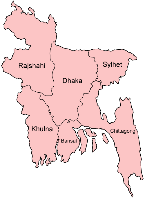
Lalmonirhat District — Infobox of BD districts native name = Lalmonirhat skyline = skyline size = skyline caption = locator position = right latd = 26.00 longd = 89.25 division name = Rajshahi Division population as of = 1991 population total = 1,088,918 population… … Wikipedia
Lalmonirhat District — noun One of the eight districts in the Rangpur Division of Bangladesh … Wiktionary
Lalmonirhat (zila) — Lalmonirhat লালমনিরহাট Zila (distrito) de Bangladés … Wikipedia Español
Lalmonirhat Sadar Upazila — Infobox of upazilas native name = Lalmonirhat Sadar locator position = right latd = 25.9153 longd = 89.4500 division name = Rajshahi Division district = Lalmonirhat District population as of = 1991 population total = 260876 population density =… … Wikipedia
Kaliganj Upazila, Lalmonirhat — Infobox of upazilas native name = Kaliganj locator position = right latd = 25.1333 longd = 89.2167 division name = Rajshahi Division district = Lalmonirhat District population as of = 1991 population total = 187494 population density = 791 area… … Wikipedia
Nilphamari District — Nilphamari District Location of Nilphamari in Bangladesh … Wikipedia
Kurigram District — Infobox of BD districts native name = Kurigram skyline = skyline size = skyline caption = locator position = right latd = 25.75 longd = 89.66 division name = Rajshahi Division population as of = 1991 population total = 1,782,277 population… … Wikipedia
Natore District — Natore District Uttara Gano Bhaban, earlier known as Natore Rajbadi, is n … Wikipedia
Mymensingh District — Mymensingh ময়মনসিংহ District Office of the District Commissioner of Mymensingh … Wikipedia