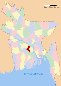
Madaripur (district)
Contenu soumis à la licence CC-BY-SA. Source : Article Madaripur (district) de Wikipédia en français (auteurs)
Regardez d'autres dictionnaires:
Madaripur District — Madaripur District Location of Madaripur in Bangladesh … Wikipedia
Madaripur District — Admin ASC 2 Code Orig. name Mādārīpur District Country and Admin Code BD.81.36 BD … World countries Adminstrative division ASC I-II
Madaripur District — noun One of the seventeen districts in the Dhaka Division of Bangladesh … Wiktionary
Madaripur (zila) — Capital Madaripur Entidad Zi … Wikipedia Español
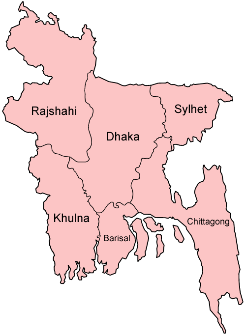
Madaripur Sadar Upazila — Infobox of upazilas native name = Madaripur Sadar locator position = right latd = 23.1667 longd = 90.2083 division name = Dhaka Division district = Madaripur District population as of = 1991 population total = 307822 population density = 981 area … Wikipedia
Shariatpur District — Infobox of BD districts native name = Shariatpur skyline = skyline size = skyline caption = locator position = right latd = 23.21 longd = 90.35 division name = Dhaka Division population as of = 1991 population total = 1,057,181 population density … Wikipedia
Uttar Dinajpur district — উত্তর দিনাজপুর জেলা Location of Uttar Dinajpur district in West Bengal State West Bengal … Wikipedia
North Dinajpur district — on the south. Uttar Dinajpur is well connected with the rest of the state through National Highways, State Highways and Railways. NH 31 and NH 34 pass through the heart of the district.The regional topography is generally flat with a gentle… … Wikipedia
Nawabganj District — Chapai Nawabganj চাঁপাই নওয়াবগঞ্জ District Coordinates … Wikipedia
Natore District — Natore District Uttara Gano Bhaban, earlier known as Natore Rajbadi, is n … Wikipedia