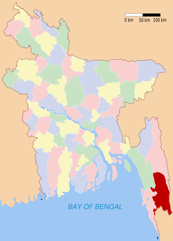
Bandarban (district)
Contenu soumis à la licence CC-BY-SA. Source : Article Bandarban (district) de Wikipédia en français (auteurs)
Regardez d'autres dictionnaires:
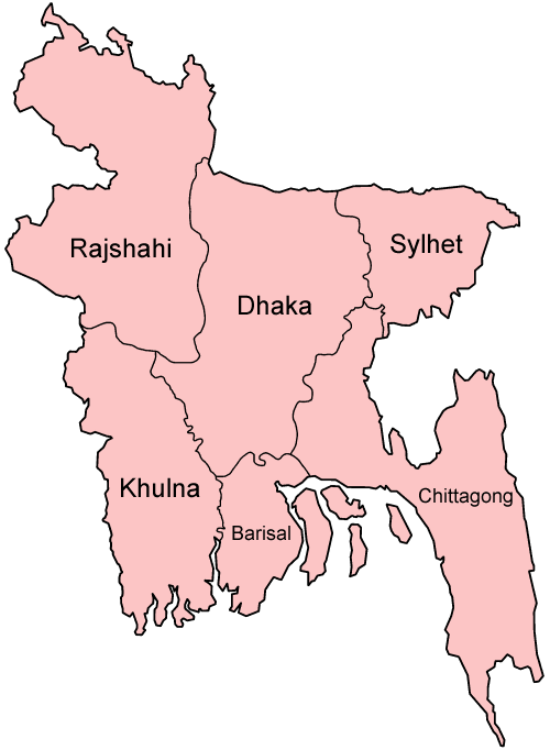
Bandarban District — Infobox of BD districts native name = Bandarban skyline = Bandarban1.jpg skyline size = skyline caption = Skyline of Bandarban locator position = left latd = 22.20 longd = 92.35 division name = Chittagong Division population as of = 1991… … Wikipedia
Bandarban District — Admin ASC 2 Code Orig. name Bāndarban District Country and Admin Code BD.84.01 BD … World countries Adminstrative division ASC I-II
Bandarban District — noun One of the eleven districts in the Chittagong Division of Bangladesh … Wiktionary
Bandarban Sadar Upazila — Infobox of upazilas native name = Bandarban Sadar locator position = right latd = 22.2333 longd = 92.1917 division name = Chittagong Division district = Bandarban District population as of = 1991 population total = 49711 population density = 99… … Wikipedia
Bandarban — noun /bʌnðɒɹ bʌn,bʌDɔr bʌn/ a) Dam of Monkeys b) A hill district in Bangladesh … Wiktionary
Barpara, Bandarban — Infobox Settlement official name = Barpara, Bandarban other name = native name = nickname = settlement type = motto = imagesize = image caption = flag size = image seal size = image shield = shield size = image blank emblem = blank emblem type =… … Wikipedia
Cox's Bazar District — Cox s Bazar District Cox s Bazar is the longest natural sea beach of the world … Wikipedia
Rangamati District — Infobox of BD districts native name = Rangamati skyline = Rangamati1.jpg skyline size = skyline caption = Rangamati skyline from Tabalchhori BDR post. locator position = left latd = 22.66 longd = 92.19 division name = Chittagong Division… … Wikipedia
Khagrachari District — Khagrachari খাগড়াছড়ি District Location of Khagrachari in Bangladesh … Wikipedia
Mymensingh District — Mymensingh ময়মনসিংহ District Office of the District Commissioner of Mymensingh … Wikipedia