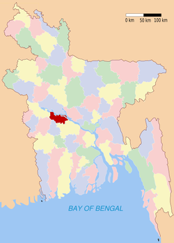
Rajbari (district)
Contenu soumis à la licence CC-BY-SA. Source : Article Rajbari (district) de Wikipédia en français (auteurs)
Regardez d'autres dictionnaires:
Rajbari District — Admin ASC 2 Code Orig. name Rājbāri District Country and Admin Code BD.81.53 BD … World countries Adminstrative division ASC I-II
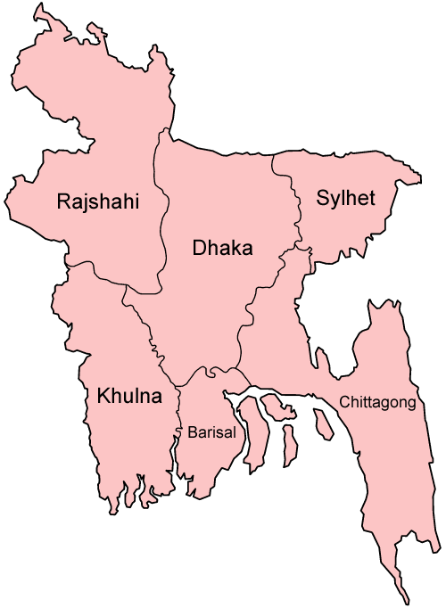
Rajbari District — Infobox of BD districts native name = Rajbari skyline = skyline size = skyline caption = locator position = right latd = 23.70 longd = 89.50 division name = Dhaka Division population as of = 1991 population total = 940,360 population density =… … Wikipedia
Rajbari District — noun One of the seventeen districts in the Dhaka Division of Bangladesh … Wiktionary
Rajbari Sadar Upazila — Infobox of upazilas native name = Rajbari Sadar locator position = right latd = 23.7542 longd = 89.6500 division name = Dhaka Division district = Rajbari District population as of = 1991 population total = 263555 population density = 842 area… … Wikipedia
Magura District — Magura মাগুরা District Location of Magura in Bangladesh … Wikipedia
Kushtia District — Infobox of BD districts native name = Kushtia skyline = Tagore Kuthibari.jpg skyline size = skyline caption = Shilaidaha Kuthibari, the famous residence of Rabindranath Tagore in Kushtia, is a popular tourist destination locator position = right… … Wikipedia
Pabna District — Pabna পাবনা জেলা District Location of Pabna in Bangladesh … Wikipedia
Jhenaidah District — Infobox of BD districts native name = Jhenaidah skyline = skyline size = skyline caption = locator position = right latd = 23.54 longd = 89.00 division name = Khulna Division population as of = 1991 population total = 1,554,514 population density … Wikipedia
Natore District — Natore District Uttara Gano Bhaban, earlier known as Natore Rajbadi, is n … Wikipedia
Naogaon District — Naogaon নওগাঁ District Location of Naogaon in Bangladesh … Wikipedia