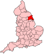
- Yorkshire de l'Est
-
East Riding of Yorkshire 
Statut Autorité unitaire Géographie Pays  Royaume-Uni
Nation Angleterre Région Yorkshire et Humber Comté Yorkshire Chef-lieu Beverley Superficie 2479 km² Code ONS 00FB Démographie Population (2007)
Densité569 195 hab.
139 hab./km²Ethnie 98,3% Blanche Le Yorkshire de l'Est (East Riding of Yorkshire en anglais) est une Autorité unitaire située dans le nord-est de l'Angleterre.
Sommaire
Étymologie
"East Riding" est dérivée de "East Thriding", de même que les autres ridings du Yorkshire. Thriding est un vieux mot anglais, d'origine saxonne, signifiant "tiers" ou "troisième partie".
Municipalités du district
- Beverley, Bishop Burton, Brandesburton, Breighton, Bridlington, Brough Broomfleet, Burnby, Burton Agnes
- Driffield
- Easington, Everingham
- Flamborough, Fridaythorpe
- Gilberdyke, Goole, Grimston
- High Catton, High Hunsley, Highfield, Holme-on-Spalding-Moor, Hollym, Hornsea, Howden, Hutton
- Kingston-upon-Hull, Kirk Ella
- Langtoft, Laxton, Long Riston
- Market Weighton, Mappleton, Marton
- Nafferton, North Cave, North End, North Ferriby, North Howden
- Ottringham
- Patrington, Pocklington
- Preston (North/South)
- Roos
- Sewerby, Skidby, Skipsea, Snaith, South Cave, Stamford Bridge, Swanland
- Thixendale, Thorngumbald
- West Ella, Withernsea, Wold Newton
Annexes
Bibliographie
- (en) K.J. Allison, The East Riding of Yorkshire Landscape, Londres, Hodder and Stoughton Limited, coll. « The Making of the English Landscape », 1976 (ISBN 0 340 15821 2)
- (en) Robert Van de Noort, The Humber Wetlands, Macclesfield, Cheshire, Windgather Press, coll. « Landscapes of Britain », 2004 (ISBN 0-9545575-4-9)
- (en) Richard Muir, The Yorkshire Countryside. A Landscape History, Edinburgh, Keele University Press, 1997 (ISBN 1 85331 198 7)
- (en) Vernon Wilson, East Yorkshire and Lincolnshire, Londres, HMSO, coll. « British Regional Geology », 1948 (OCLC 2281266)
Wikimedia Foundation. 2010.
