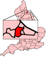
Stockton-on-Tees (borough)
Contenu soumis à la licence CC-BY-SA. Source : Article Stockton-on-Tees (borough) de Wikipédia en français (auteurs)
Regardez d'autres dictionnaires:
Stockton-on-Tees (borough) — Infobox UK district name = Borough of Stockton on Tees status = Unitary, Borough region = North East England admincounty = Durham and North Yorkshire area = Ranked 186th 203.89 km² adminhq = Stockton on Tees onscode = 00EF population = Ranked… … Wikipedia
Stockton-on-Tees (Borough) — Borough of Stockton on Tees Basisdaten Status Unitary Authority, Borough Region … Deutsch Wikipedia
Stockton-on-Tees — Koordinaten … Deutsch Wikipedia
Stockton-on-Tees — Coordinates: 54°34′N 1°19′W / 54.57°N 1.32°W / 54.57; 1.32 … Wikipedia
Stockton-on-tees — (français : Stockton sur Tees) est une ville industrielle et un port dans le comté de Durham dans le nord est de l Angleterre. Elle possède 80 600 habitants. Géographie Stockton on Tees se trouve sur la côte est de l Angleterre, sur la rive… … Wikipédia en Français
Stockton on Tees — (spr. tīs), Stadt (municipal borough) in der engl. Grafschaft Durham, links am Tees, 6 km oberhalb Middlesbrough, mit South S. (im Nordbezirk von Yorkshire) durch zwei Brücken verbunden. Beide zusammen haben (1901) 51,478 Einw. S. hat mehrere… … Meyers Großes Konversations-Lexikon
Stockton-on-Tees — 54° 34′ N 1° 19′ W / 54.57, 1.32 … Wikipédia en Français
Stockton-on-Tees (UK Parliament constituency) — UK former constituency infobox Name = Stockton on Tees Type = Borough Year = 1868 Abolition = 1983 members = oneStockton on Tees is a former constituency represented in the House of Commons of the Parliament of the United Kingdom. It elected one… … Wikipedia
Borough of Stockton-on-Tees — Admin ASC 2 Code Orig. name Borough of Stockton on Tees Country and Admin Code GB.ENG.N3 GB … World countries Adminstrative division ASC I-II
Newtown, Stockton-on-Tees — Newtown is an area of Stockton on Tees within the borough of Stockton on Tees and the ceremonial county of County Durham, England. It is situated close to the north west end of the town centre. Coordinates: 54°34′16″N 1°19′19″W / … Wikipedia

 Royaume-Uni