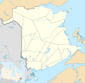
- Indian Island 28
-
Indian Island 28 Administration Pays  Canada
Province  Nouveau-Brunswick
Comté ou équivalent Kent Statut municipal Réserve indienne Démographie Population 97 hab. (2006) Densité 360.3 hab./km2 Langue(s) Anglais Géographie Coordonnées
géographiquesAltitude mini. 0 m — maxi. m Superficie 0,27 km2 Fuseau horaire UTC-4 Indicatif +1-506 Géolocalisation sur la carte : Nouveau-Brunswick
modifier 
Indian Island 28 est une réserve indienne canadienne située dans le Kent, à l'est du Nouveau-Brunswick.
Sommaire
Géographie
Indian Island est situé sur la pointe Sock, à 5 kilomètres à l'est de Richibouctou. Le village est au bord de la passe de l'île, un bras de la rivière Richibouctou la séparant de l'île Indian.
Géologie
Le sous-sol d'Indian Island est composé principalement de roches sédimentaires du groupe de Pictou datant du Pennsylvanien (entre 300 et 311 millions d'années)[1].
Administration
Indian Island 28 est la seule réserve de la Première nation micmaque Indian Island.
Conseil de bande
Mandat Fonctions Nom(s) 2010 - 2012 Chef Kenneth Barlow Conseillers Geronimo Barlow, Ingrid Brooks. Liste des chefs successifs de la première nation d'Indian Island Parti Mandat Nom Indépendant 2010- Kenneth Barlow Représentation et tendances politiques
 Nouveau-Brunswick: Indian Island 28 fait partie de la circonscription provinciale de Kent, qui est représentée à l'Assemblée législative du Nouveau-Brunswick par Shawn Graham, ancien Premier ministre du Nouveau-Brunswick. Il fut élu en 1999 puis réélu en 1999, en 2003, en 2006 et en 2010.
 Canada: Indian Island 28 fait partie de la circonscription fédérale de Beauséjour. Cette circonscription est représentée à la Chambre des communes du Canada par Dominic LeBlanc, du Parti libéral.
Vivre à Indian Island
L'église Blessed Keteri est une église catholique romaine faisant partie de l'archidiocèse de Moncton.
Municipalités limitrophes
Notes et références
Notes
Références
- (en) [PDF] Ministère des Ressources naturelles et de l'énergie du Nouveau-Brunswick, « Bedrock Geology of New Brunswick », 2000. Consulté le 19 juin 2009
Catégories :- Comté de Kent (Nouveau-Brunswick)
- Municipalité du Nouveau-Brunswick
- Réserve indienne du Nouveau-Brunswick
Wikimedia Foundation. 2010.


