District d'Upper Dir
- District d'Upper Dir
-
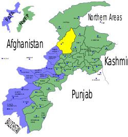
Le district d'Upper Dir est une subdivision administrative de la province Khyber Pakhtunkhwa au Pakistan.
Guerre contre le terrorisme
D'avril à juillet 2009, l'armée pakistanaise concentre des opérations militaires contre les insurgés islamistes dans la région.
Voir aussi
Articles connexes
Catégorie : - District de la province de Khyber Pakhtunkhwa
Wikimedia Foundation.
2010.
Contenu soumis à la licence CC-BY-SA. Source : Article District d'Upper Dir de Wikipédia en français (auteurs)
Regardez d'autres dictionnaires:
District de Lower Dir — Carte des régions tribales (en bleu) et de Khyber Pakhtunkhwa (en vert) Administration Pays … Wikipédia en Français
Upper Dir District — Infobox Pakistan district district = Upper Dir District area = population = pop year = density = caption =Location of Dir District (highlighted in yellow) within the North West Frontier Province of Pakistan. region = North West Frontier Province… … Wikipedia
Upper Dir District — Admin ASC 2 Code Orig. name Upper Dīr District Country and Admin Code PK.03.1179754 PK … World countries Adminstrative division ASC I-II
District de Malakand — 34°30′N 71°45′E / 34.5, 71.75 … Wikipédia en Français
District de Swat — 35°23′N 72°11′E / 35.383, 72.183 … Wikipédia en Français
Dir District — was a district of the Khyber Pakhtunkhwa Province of Pakistan between 1970 and 1996. It was part of Malakand Division. Dir District was created in 1970 after the princely state of Dir was abolished the year before. Dir District was 5,280 square… … Wikipedia
District de Mardan — Le district de Mardan est en jaune sur la carte. Il fait partie de la province de Khyber Pakhtunkhwa (en vert). Les régions tribales sont en bleu. Administration Pays … Wikipédia en Français
District d'Hangu (Pakistan) — District d Hangu Le district d Hangu est en rouge sur la carte. Il fait partie de la province de Khyber Pakhtunkhwa (en vert). Les régions tribales sont en bleu. Administration Pays … Wikipédia en Français
District de Bannu — La province Khyber Pakhtunkhwa (en vert), le district de Bannu en rouge Administration Pays … Wikipédia en Français
District de Charsadda — Le district de Charsadda est en rouge sur la carte. Il fait partie de la province de Khyber Pakhtunkhwa (en vert). Les régions tribales sont en bleu. Administration Pays … Wikipédia en Français
 Pakistan