District de Bannu
- District de Bannu
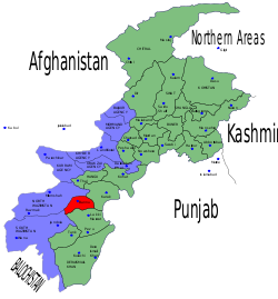
-
Le district de Bannu est une subdivision administrative de la province Khyber Pakhtunkhwa au Pakistan.
Guerre contre le terrorisme
À cause de sa proximité avec les régions tribales, le district de Bannu est au centre du conflit armé du Nord-Ouest du Pakistan et est régulièrement frappé par des attentats à la bombe.
Voir aussi
Articles connexes
Catégorie :
- District de la province de Khyber Pakhtunkhwa
Wikimedia Foundation.
2010.
Contenu soumis à la licence CC-BY-SA. Source : Article District de Bannu de Wikipédia en français (auteurs)
Regardez d'autres dictionnaires:
Bannu Division — was an administrative division of the North West Frontier Province of Pakistan, until the reforms of 2000 abolished the third tier of government. The division was created in the 1990 s when it was removed from Dera Ismail Khan Division, at… … Wikipedia
Bannu District — Infobox Pakistan district district = Bannu District area = 1227 population = 677,346 pop year = density = 552 caption = Location of Bannu District (highlighted in red) within the North West Frontier Province. region = North West Frontier Province … Wikipedia
Bannu — Location of Bannu District (highlighted in red) within the Khyber Pakhtunkhwa map Bannu (Urdu: بنوں; Pashto: بنو [ˈbanu], Bana or Bani Gul) is the principal city of the Bannu District in the Khyber Pakhtunkh … Wikipedia
Bannu Airport — IATA: BNP – ICAO: OPBN Summary Airport type Public Operator Pakistan Civil Aviation Authority Serves … Wikipedia
District de Lower Dir — Carte des régions tribales (en bleu) et de Khyber Pakhtunkhwa (en vert) Administration Pays … Wikipédia en Français
District d'Upper Dir — Le district de Dir est en jaune sur la carte. Il fait partie de la province de Khyber Pakhtunkhwa (en vert). Les régions tribales sont en bleu. Administration Pays … Wikipédia en Français
District de Mardan — Le district de Mardan est en jaune sur la carte. Il fait partie de la province de Khyber Pakhtunkhwa (en vert). Les régions tribales sont en bleu. Administration Pays … Wikipédia en Français
District d'Hangu (Pakistan) — District d Hangu Le district d Hangu est en rouge sur la carte. Il fait partie de la province de Khyber Pakhtunkhwa (en vert). Les régions tribales sont en bleu. Administration Pays … Wikipédia en Français
District de Charsadda — Le district de Charsadda est en rouge sur la carte. Il fait partie de la province de Khyber Pakhtunkhwa (en vert). Les régions tribales sont en bleu. Administration Pays … Wikipédia en Français
District de Dera Ismail Khan — Le district de Dera Ismail Khan est en rouge sur la carte. Il fait partie de la province de Khyber Pakhtunkhwa (en vert). Les régions tribales sont en bleu. Administration Pays … Wikipédia en Français
 Pakistan