- Interstate 195
-
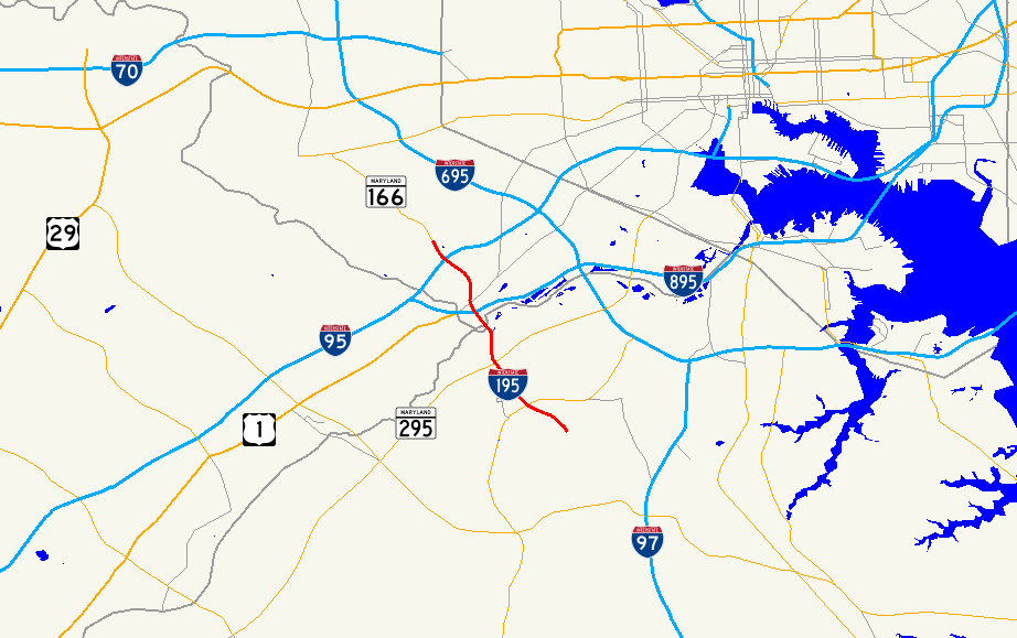
Interstate 195 (Maryland) 

Longueur 7,85 km (4,88 mi) Ouverture 1985 Extrémité Ouest 
 I-95/MD 166 près de Catonsville
Intersections  MD 295
Extrémité Est  Aéroport international Thurgood Marshall de Baltimore-Washington
Réseau Interstate highway L'Interstate 195 (Maryland) (ou I-195 ou Metropolitan Boulevard) est une autoroute inter-États de 7,85 kilomètres de long située au sud de la ville de Baltimore aux États-Unis d'Amérique.
L’autoroute relie l’Interstate 95 à l’aéroport international Thurgood Marshall de Baltimore-Washington. D’autres autoroutes portent également le numéro 195 dans d’autres états américains.
Description
Bien que l'autoroute commence au départ de l’Interstate 95, la voie débute en réalité à l’intersection avec la Maryland Route 166 au niveau de Catonsville. Elle permet de joindre le boulevard de l’université UMBC. Elle traverse ensuite en direction du sud-est le fleuve Patapsco avant de se terminer au niveau de l’aéroport. La vitesse y est en général limitée à 96 km/h (60 mile/h)
Autoroutes inter-États (principales en rose) 
4 5 8 10 12 15 16 17 19 20 22 24 25 26 27 29 30 35 37 39 40 43 44 45 49 55 57 59 64 65 66 68 69 70 71 72 73 74 75 76 (W) 76 (E) 77 78 79 80 81 82 83 84 (W) 84 (E) 85 86 (W) 86 (E) 87 88 (W) 88 (E) 89 90 91 93 94 95 96 97 99 (238) H-1 H-2 H-3 Autres A-1 A-2 A-3 A-4 PRI-1 PRI-2 PRI-3 Catégories :- Autoroute inter-États américaine
- Route du Maryland

Wikimedia Foundation. 2010.