- Interstate 26
-
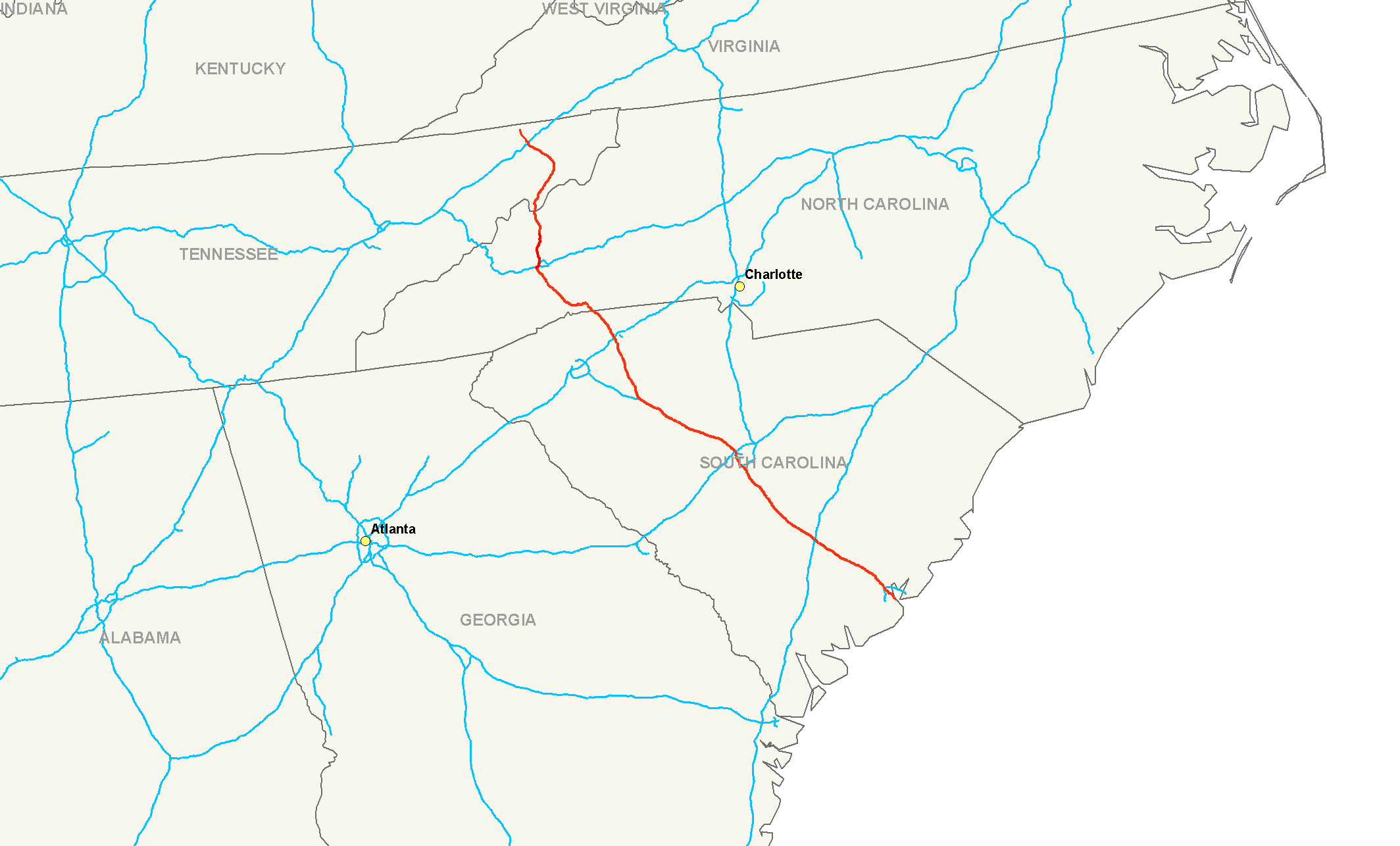
Interstate 26 
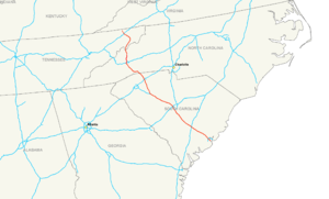
Longueur 558 km (347 mi) Direction ouest / est Extrémité ouest 
 U.S. Route 11W/U.S. Route 23 à Kingsport (Tennessee)
Intersections  Interstate 81 à Colonial Heights
 Interstate 40 à Asheville
 Interstate 85 à Spartanburg
 Interstate 20 près de Columbia (Caroline du Sud)
 Interstate 77 près de Columbia
 Interstate 95 près de Rosinville
Extrémité est  US Route 17 à Charleston (Caroline du Sud)
Réseau Interstate highway L'Interstate 26 (en abrégé I-26) est une autoroute inter-états située au sud-est des États-Unis d'Amérique.
Distances
Miles km État 55 89 Tennessee 71 114 Caroline du Nord 220.95 355.58 Caroline du Sud 347 558 Total Routes auxiliaires
- L'Interstate 126 à Columbia, Caroline du Sud.
- L'Interstate 526, une rocade de Charleston, Caroline du Sud.
Voir aussi
- (en) Cet article est partiellement ou en totalité issu de l’article de Wikipédia en anglais intitulé « Interstate 26 » (voir la liste des auteurs)
Autoroutes inter-États (principales en rose) 
4 5 8 10 12 15 16 17 19 20 22 24 25 26 27 29 30 35 37 39 40 43 44 45 49 55 57 59 64 65 66 68 69 70 71 72 73 74 75 76 (W) 76 (E) 77 78 79 80 81 82 83 84 (W) 84 (E) 85 86 (W) 86 (E) 87 88 (W) 88 (E) 89 90 91 93 94 95 96 97 99 (238) H-1 H-2 H-3 Autres A-1 A-2 A-3 A-4 PRI-1 PRI-2 PRI-3 Catégorie :- Autoroute inter-États américaine

Wikimedia Foundation. 2010.