- Interstate 20
-
Interstate 20 
Longueur 2470 km (1535 mi) Ouverture 1957 Direction ouest / est Extrémité ouest  I-10 à Kent, TX
Intersections  I-35 à Fort Worth, TX
I-35 à Dallas, TX
 I-45 à Dallas, TX
 I-49 à Shreveport, LA
 I-55 à Jackson, MS
 I-59 près de Meridian, MS et à Birmingham, AL
 I-65 à Birmingham, AL

 I-75/I-85 à Atlanta, GA
Extrémité est 
 I-95/Business Spur 20 près de Florence, SC
Réseau Interstate highway L'Interstate 20 est une autoroute inter-états majeure est-ouest située au sud-est des États-Unis d'Amérique. Elle rejoint Kent (Texas) à l'Interstate 10, à l'Interstate 95 à Florence (Caroline du Sud), et mesure 2 470 km de long.
Distances
Miles km 634 1,020 Texas 189 304 Louisiane 154.5 248.6 Mississippi 215 346 Alabama 201 324 Géorgie 141 227 Caroline du Sud 1,535 2,470 Total Principales villes traversées
- El Paso, Texas
- Odessa, Texas
- Midland, Texas
- Abilene, Texas
- Fort Worth, Texas
- Dallas, Texas
- Tyler, Texas
- Longview, Texas
- Shreveport, Louisiane
- Monroe, Louisiane
- Vicksburg, Mississippi
- Jackson, Mississippi
- Meridian, Mississippi
- Tuscaloosa, Alabama
- Birmingham, Alabama
- Atlanta, Géorgie
- Augusta, Géorgie
- Columbia, Caroline du Sud
- Florence, Caroline du Sud
Voir aussi
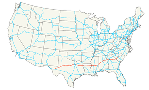
Autoroutes inter-États (principales en rose) 
4 5 8 10 12 15 16 17 19 20 22 24 25 26 27 29 30 35 37 39 40 43 44 45 49 55 57 59 64 65 66 68 69 70 71 72 73 74 75 76 (W) 76 (E) 77 78 79 80 81 82 83 84 (W) 84 (E) 85 86 (W) 86 (E) 87 88 (W) 88 (E) 89 90 91 93 94 95 96 97 99 (238) H-1 H-2 H-3 Autres A-1 A-2 A-3 A-4 PRI-1 PRI-2 PRI-3 Catégorie :- Autoroute inter-États américaine


Wikimedia Foundation. 2010.