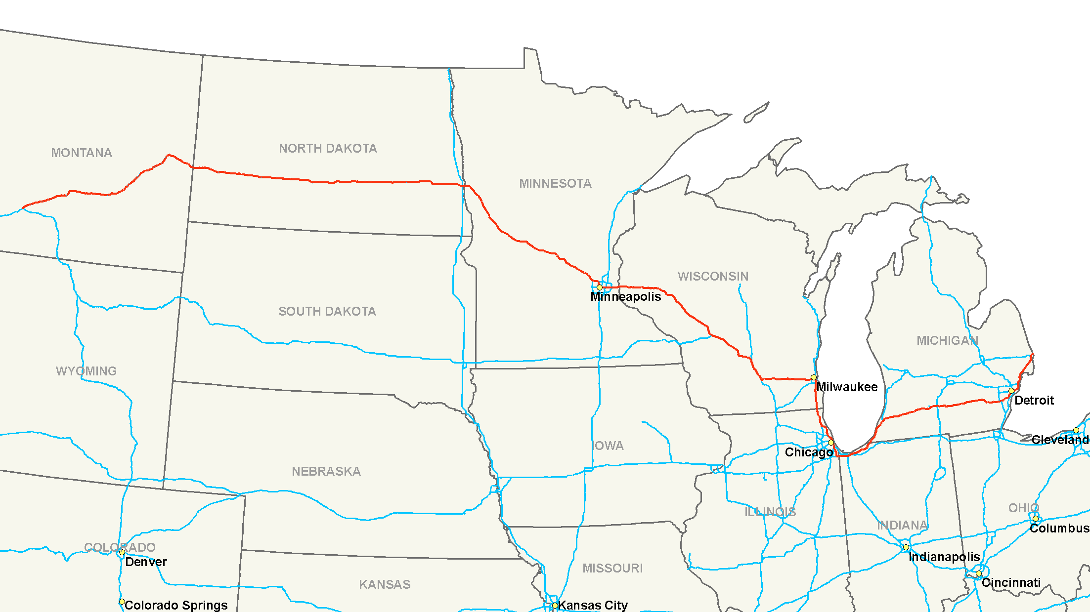
- Interstate 94
-
Interstate 94 
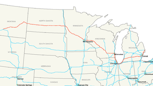
Longueur 2581 km (1604 mi) Direction ouest / est Extrémité ouest  I-90 à Billings, MT
Intersections  I-29 à Fargo, ND
 I-35W à Minneapolis, MN
 I-35E in Saint Paul, MN

 jonction à Tomah, WN
bifurcation à Madison, WN
 I-55 à Chicago, IL
à Chicago, IL


 I-80/294/IL 394 near Lansing, IL
 I-65 à Gary, IN
in Lake Station, IN
 I-75 à Détroit, MN
Extrémité est  I-95 à Port Huron, MN
Réseau Interstate highway L'Interstate 94 (ou I-94) est une autoroute inter-États de 2581 kilomètres de long située aux États-Unis d'Amérique. Elle joint l'Interstate 90 à Billings (Montana) à l'Ontario Highway 402, à Port Huron, Michigan.
Sommaire
Distances

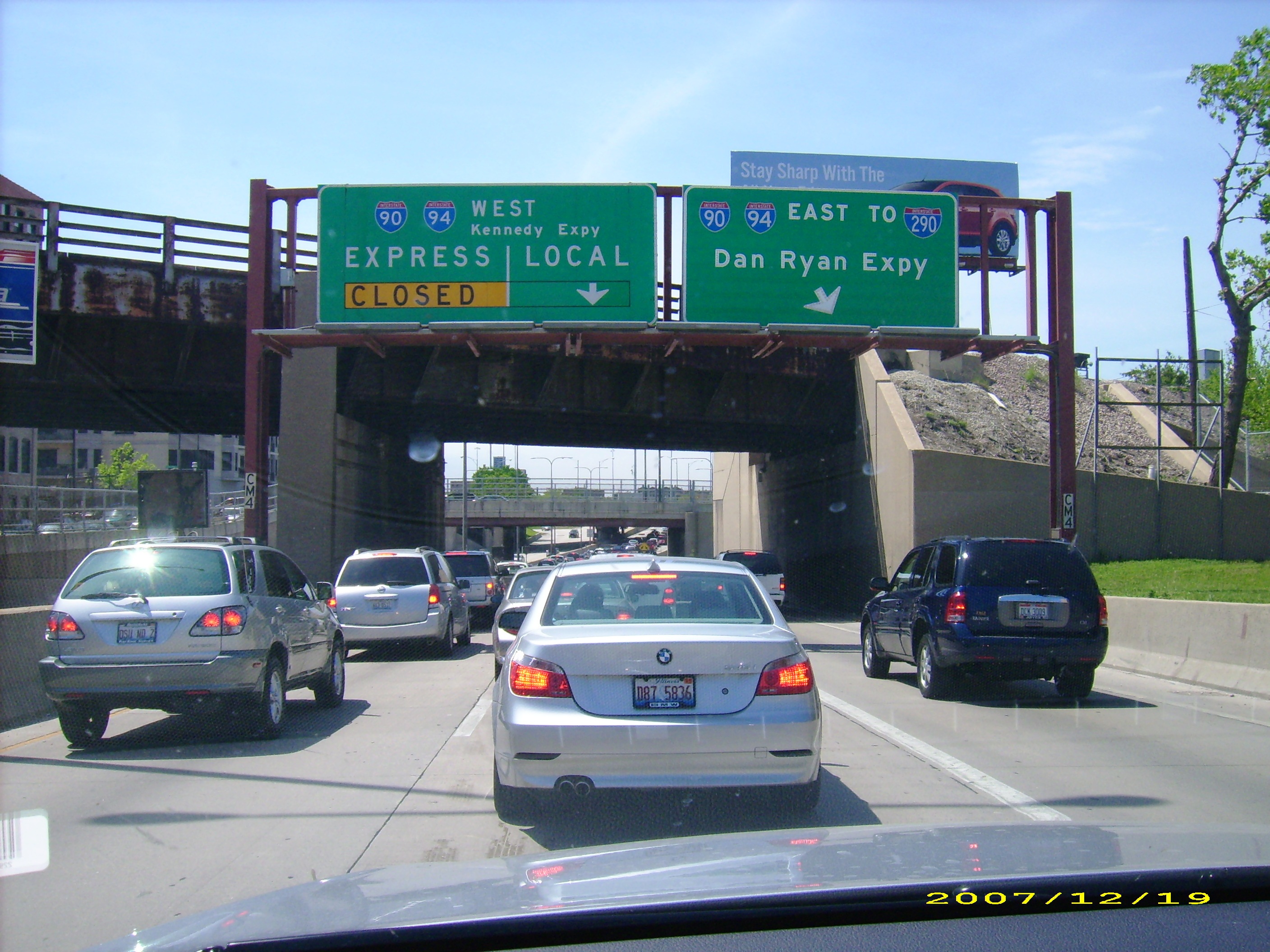
 Même avec des voies d'express, l'Interstate 94 est fréquemment congestionée quand elle passe par le centre-ville de Chicago (Illinois, États-Unis).
Miles km État 249.15 400.97 Montana 352.39 567.12 Dakota du Nord 259.49 417.61 Minnesota 348 560 Wisconsin 77 124 Illinois 46.13 74.24 Indiana 275.49 443.36 Michigan 1604 2581 Total [1] Principales villes traversées
- Billings (Montana)
- Bismarck (Dakota du Nord)
- Fargo (Dakota du Nord)
- Moorhead (Minnesota)
- Saint Cloud (Minnesota)
- Maple Grove (Minnesota)
- Brooklyn Park (Minnesota)
- Brooklyn Center (Minnesota)
- Minneapolis (Minnesota)
- Saint Paul (Minnesota)
- Maplewood (Minnesota)
- Woodbury (Minnesota)
- Eau Claire (Wisconsin)
- Wisconsin Dells (Wisconsin)
- Madison (Wisconsin) (Wisconsin)
- Waukesha (Wisconsin)
- West Allis (Wisconsin)
- Milwaukee (Wisconsin)
- Racine (Wisconsin)
- Kenosha (Wisconsin)
- Waukegan Illinois)
- Chicago (Illinois)
- Gary (Indiana)
- Kalamazoo (Michigan)
- Battle Creek (Michigan)
- Jackson (Michigan)
- Ann Arbor (Michigan)
- Détroit (Michigan)
- Port Huron (Michigan)
Notes
Voir aussi
- (en) Cet article est partiellement ou en totalité issu de l’article de Wikipédia en anglais intitulé « Interstate 94 » (voir la liste des auteurs)
Autoroutes inter-États (principales en rose) 
4 5 8 10 12 15 16 17 19 20 22 24 25 26 27 29 30 35 37 39 40 43 44 45 49 55 57 59 64 65 66 68 69 70 71 72 73 74 75 76 (W) 76 (E) 77 78 79 80 81 82 83 84 (W) 84 (E) 85 86 (W) 86 (E) 87 88 (W) 88 (E) 89 90 91 93 94 95 96 97 99 (238) H-1 H-2 H-3 Autres A-1 A-2 A-3 A-4 PRI-1 PRI-2 PRI-3 Liens externes
Catégorie :- Autoroute inter-États américaine


Wikimedia Foundation. 2010.