Kapelle-op-den-Bos
- Kapelle-op-den-Bos
-
| Kapelle-op-den-Bos |
|
|
|
|
|
| Géographie |
| Pays |
 Belgique Belgique |
| Région |
 Région flamande Région flamande |
| Communauté |
Communauté flamande |
| Province |
 Province du Brabant flamand Province du Brabant flamand |
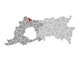
| Arrondissement |
Hal-Vilvorde |
| Coordonnées |
51° 00′ N 4° 21′ E / 51, 4.3551° 00′ Nord
4° 21′ Est / 51, 4.35 |
Superficie
– Surface agricole
– Bois
– Terrains bâtis
– Divers |
15,25 km² (2005)
66,86 %
2,60 %
28,43 %
2,11 % |
| Données sociologiques |
Population
– Hommes
– Femmes
Densité |
8 969 (1er janvier 2008)
48,68 %
51,32 %
588 hab./km² |
Pyramide des âges
– 0–17 ans
– 18–64 ans
– 65 ans et + |
(1er janvier 2008)
19,11 %
63,89 %
17,00 % |
| Étrangers |
1,56 % (1er janvier 2008) |
| Économie |
| Taux de chômage |
2,93 % (janvier 2009) |
| Revenu annuel moyen |
16 341 €/hab. (2005) |
| Politique |
| Bourgmestre |
Leo Peeters (sp.a) |
| Majorité |
sp.a, CD&V |
Sièges
sp.a
CD&V
VLD
Groen!
N-VA |
19
10
5
2
1
1 |
| Sections de commune |
| Section |
Code postal |
Kapelle-op-den-Bos
Nieuwenrode
Ramsdonk |
1880
1880
1880 |
| Autres informations |
| Gentilé |
(inconnu) |
| Zone téléphonique |
015 - 02 - 03 - 052 |
| Code INS |
23039 |
| Site officiel |
www.kapelle-op-den-bos.be |
modifier  |
Kapelle-op-den-Bos (aussi Chapelle-au-Bois en français) est une commune néerlandophone de Belgique située en Région flamande, dans la province du Brabant-Flamand.
Histoire
Jadis, la mairie de Kapelle-op-den-Bos comprenant 10 villages faisait partie du Quartier de Bruxelles.
Site externe
Catégorie :
- Commune de la province du Brabant flamand
Wikimedia Foundation.
2010.
Contenu soumis à la licence CC-BY-SA. Source : Article Kapelle-op-den-Bos de Wikipédia en français (auteurs)
Regardez d'autres dictionnaires:
Kapelle-op-den-Bos — Coat of arms … Wikipedia
Kapelle-op-den-Bos — Kapelle op den Bos … Deutsch Wikipedia
Kapelle-Op-Den-Bos — Kapelle op den Bos … Wikipédia en Français
Kapelle-op-den-bos — Kapelle op den Bos … Wikipédia en Français
Kapelle-op-den-Bos — Original name in latin Kapelle op den Bos Name in other language Chapelle au Bois, Kapelle op den Bos State code BE Continent/City Europe/Brussels longitude 51.0097 latitude 4.36303 altitude 12 Population 8859 Date 2011 02 04 … Cities with a population over 1000 database
Kapelle — (von lat. capella, ,geteilt‘, urpr. zur Mantelhälfte des Hl. Martin) steht für: Kapelle (Kirchenbau), baulich kleine Bet oder Gottesdiensträume, kirchenrechtlich Kirchengebäude oder Räume ohne Rechtsstellung als Kirche Kapelle (Amtstracht), ein… … Deutsch Wikipedia
Kapelle (disambiguation) — Kapelle is the name of several locations in the Netherlands and Belgium:In Belgium: * Kapelle op den Bos, a town in Flemish Brabant * Kapellen, Belgium, a town in the Belgian province of Antwerp is a homonym * Westkapelle, a village in West… … Wikipedia
List of postal codes in Belgium — Belgian postal codes are numeric and consist of 4 numbers, although the last one is often zero. The first digit indicates the province (except for the 3xxx numbers that are shared by the eastern part of Flemish Brabant and Limburg and the and… … Wikipedia
Leuven — Löwen … Deutsch Wikipedia
Löwen (Belgien) — Löwen … Deutsch Wikipedia