Huldenberg
- Huldenberg
-
 Huldenberg Huldenberg |
|
|
|
|
|
| Géographie |
| Pays |
 Belgique Belgique |
| Région |
 Région flamande Région flamande |
| Communauté |
 Communauté flamande Communauté flamande |
| Province |
 Province du Brabant flamand Province du Brabant flamand |
| Arrondissement |
Louvain |
| Coordonnées |
50° 47′ 00″ N 4° 34′ 00″ E / 50.783333333333, 4.566666666666750° 47′ 00″ Nord
4° 34′ 00″ Est / 50.783333333333, 4.5666666666667 |
Superficie
– Surface agricole
– Bois
– Terrains bâtis
– Divers |
39,64 km² (2005)
58,12 %
18,39 %
18,06 %
5,43 % |
| Données sociologiques |
Population
– Hommes
– Femmes
Densité |
9 300 (1er janvier 2008)
48,85 %
51,15 %
235 hab./km² |
Pyramide des âges
– 0–17 ans
– 18–64 ans
– 65 ans et + |
(1er janvier 2008)
22,65 %
61,00 %
16,35 % |
| Étrangers |
6,88 % (1er janvier 2008) |
| Économie |
| Taux de chômage |
3,94 % (janvier 2009) |
| Revenu annuel moyen |
16 151 €/hab. (2005) |
| Politique |
| Bourgmestre |
Georges Vanderlinden (VLD) |
| Majorité |
VLD, sp.a |
Sièges
VLD
CD&V
sp.a
Groen! |
19
10
5
3
1 |
| Sections de commune |
| Section |
Code postal |
Huldenberg
Loonbeek
Neerijse
Ottembourg
Rhode-Sainte-Agathe |
3040
3040
3040
3040
3040 |
| Autres informations |
| Gentilé |
(inconnu) |
| Zone téléphonique |
016 - 02 |
| Code INS |
24045 |
| Site officiel |
www.huldenberg.be |
modifier  |
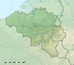
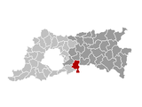
Huldenberg est une commune néerlandophone de Belgique située en Région flamande dans la province du Brabant flamand. La commune comprend les villages de Huldenberg, Loonbeek, Neerijse, Ottenburg (Ottembourg en français) et Sint-Agatha-Rode (Rhode-Sainte-Agathe en français).
Site externe
Sur les autres projets Wikimedia :
Catégorie :
- Commune de la province du Brabant flamand
Wikimedia Foundation.
2010.
Contenu soumis à la licence CC-BY-SA. Source : Article Huldenberg de Wikipédia en français (auteurs)
Regardez d'autres dictionnaires:
Huldenberg — Huldenberg … Deutsch Wikipedia
Huldenberg — Infobox Belgium Municipality name=Huldenberg picture= picture map arms=Wapenschild huldenberg.png region=BE REG FLE community=BE NL province=BE PROV VB arrondissement=Leuven nis=24045 pyramid date= 0 19= 20 64= 65= foreigners= foreigners date=… … Wikipedia
Huldenberg — Original name in latin Huldenberg Name in other language Huldenberg State code BE Continent/City Europe/Brussels longitude 50.78939 latitude 4.5831 altitude 48 Population 9137 Date 2011 02 15 … Cities with a population over 1000 database
Huldenbergschlösschen — Das Ledererschlössel war ein historisches Bauwerk in der Mühlbergstraße 8 in Wien Weidlingau. Inhaltsverzeichnis 1 Namensgebung 2 Errichtung, Umgestaltung, Demolierung 3 Nachnutzung 4 Literatur 5 Weblink … Deutsch Wikipedia
Overijse — Overijse … Deutsch Wikipedia
B&B Park7 — (Huldenberg,Бельгия) Категория отеля: 2 звездочный отель Адрес: Kasteelpark 7, 3040 Hulden … Каталог отелей
Scheldt — Infobox River | river name = Scheldt caption = The Scheldt in Antwerp origin = France mouth = North Sea coord|51|25|51|N|3|31|44|E|name=North Sea Scheldt|display=inline,title basin countries = France, Belgium, Netherlands length = 350 km (217 mi) … Wikipedia
List of rivers of Belgium — These are the main rivers of Belgium.All of Belgium is drained into the North Sea, except the municipality of Momignies (Macquenoise), which is drained by the Oise river into the English Channel. Rivers that flow into the sea are sorted… … Wikipedia
Dijle — See also: Dyle, Poland Location of the Dijle Dyle (French) or Dijle (Dutch) or historically the River Dyle in English, is a river in central Belgium, left tributary of the Rupel. It is 86 km (53 mi) long. It flows through the Belgian… … Wikipedia
Aerschot — Aarschot … Deutsch Wikipedia
 Huldenberg
 Belgique
 Région flamande
 Communauté flamande
 Province du Brabant flamand


