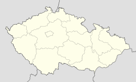
Seč (Chrudim)
Contenu soumis à la licence CC-BY-SA. Source : Article Seč (Chrudim) de Wikipédia en français (auteurs)
Regardez d'autres dictionnaires:
Seč (Chrudim District) — See other places named Seč. Geobox | Settlement name = Seč other name = category = Town image caption = symbol = Sec znak.gif etymology = official name = motto = nickname = country = Czech Republic country state = region = Pardubice region type … Wikipedia
Seč u Nasavrk — Seč … Deutsch Wikipedia
Chrudim District — Okres Chrudim District Chrudim town … Wikipedia
Chrudim — Chrudim … Deutsch Wikipedia
Seč — ist der Name von Seč u Nasavrk, Stadt im Okres Chrudim, Tschechien Seč u Blovic, Gemeinde im Okres Plzeň jih, Tschechien Seč u Brandýsa nad Orlicí, Gemeinde im Okres Ústí nad Orlicí Seč (Slowakei), Gemeinde im Okres Prievidza, Slowakei Seč,… … Deutsch Wikipedia
Seč — is name of several locations in central Europe:* Seč, a village in Pardubice Region (Chrudim District) of the Czech Republic ** Seč dam next to the Seč village * Seč, a village in the Trenčín Region (Prievidza District) of Slovakia … Wikipedia
Chrudim — Coordinates: 49°57′4″N 15°47′44″E / 49.95111°N 15.79556°E / 49.95111; 15.79556 … Wikipedia
Okres Chrudim — Kraj Pardubický kraj Fläche 992,62 km² Einwohner • Bevölkerungsdichte 103 266 (2007) 104 Einw./km² Gemeinden • davon Städte • davon … Deutsch Wikipedia
District de Chrudim — Okres Chrudim (cs) Administration … Wikipédia en Français
Chrast (Chrudim District) — See other locations named Chrast and Chrást. Coordinates: 49°54′6″N 15°55′56″E / 49.90167°N 15.93222°E / … Wikipedia


 République tchèque
