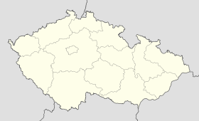
Holetín
Contenu soumis à la licence CC-BY-SA. Source : Article Holetín de Wikipédia en français (auteurs)
Regardez d'autres dictionnaires:
Holetín — is a village in the Pardubice Region of the Czech Republic. It has around 750 inhabitants.The village consists from administrative parts Dolní Holetín, Horní Babákov and Horní Holetín. External links * [http://portal.gov.cz/wps/portal/… … Wikipedia
Pension Holetín — (Horní Holetín,Чехия) Категория отеля: 4 звездочный отель Адрес: Horní Holetín 55, H … Каталог отелей
Raná u Hlinska — Raná … Deutsch Wikipedia
Kladno u Hlinska — Kladno … Deutsch Wikipedia
District de Chrudim — Okres Chrudim (cs) Administration … Wikipédia en Français
Chrudim — Coordinates: 49°57′4″N 15°47′44″E / 49.95111°N 15.79556°E / 49.95111; 15.79556 … Wikipedia
Chrudim District — Okres Chrudim District Chrudim town … Wikipedia
Chrast (Chrudim District) — See other locations named Chrast and Chrást. Coordinates: 49°54′6″N 15°55′56″E / 49.90167°N 15.93222°E / … Wikipedia
Nasavrky (Chrudim District) — Location of Nasavrky in the Czech Republic See other places named Nasavrky. Nasavrky is a town in the Pardubice Region of the Czech Republic. It has around 1,500 inhabitants. Villages Villages Březovec, Drahotice, Libáň, Nová Ves, Obořice, Ochoz… … Wikipedia
Chroustovice — Coordinates: 49°57′22″N 15°59′40″E / 49.95611°N 15.99444°E / 49.95611; 15.99444 … Wikipedia
 République tchèque
