- Aéroport international de Bandung
-
Demande de traduction ---
 Husein Sastranegara International Airport →
  Aéroport international de Bandung --- (+)
Aéroport international Husein Sastranegara 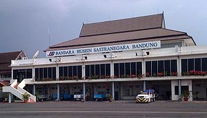

Code AITA Code OACI BDO WICC Localisation Pays  Indonésie
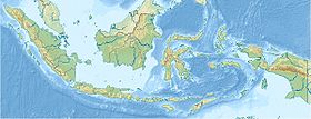
Ville desservie Bandung, Java Ouest Coordonnées Altitude 742 m (2 436 ft) Géolocalisation sur la carte : Indonésie

Pistes Direction Longueur Surface 11/29 2 244 m (7 362 ft) asphalte Informations aéronautiques Type d'aéroport Commercial Gestionnaire PT Angkasa Pura II (Persero)
Public Company LimitedCatégories Aéroports • Aéroports indonésiens modifier 
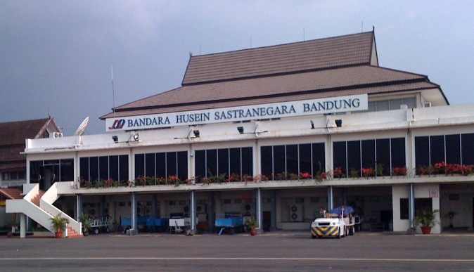
L' aéroport international de Bandung Husein Sastranegara (Bandar Udara Internasional Husein Sastranegara) (code AITA : BDO • code OACI : WICC)[1] est le principal aéroport de la ville de Bandung dans la province de Java Ouest en Indonésie. Il occupe une superficie de 145 hectares. The airport serves the area of civil aviation in the south western part. While on the north side of the runway, there is a hangar owned by PT Dirgantara Indonesia. Moreover Airport is also equipped with PAPI (Precision Approach Path Indicator) and VOR (VHF Omnidirectional Range), devices that help the plane landed at night and other navigation tools. The airport (and the city of Bandung itself) is surrounded by mountains, making landing approach to be difficult. Since 1 February 2009 international flight's passengers are required to pay an airport tax of IDR 75,000[2]. this airport can handle aircrafts types A320, Boeing 737, CASA CN-235, F28 and some narrow-small aircraft. Until late 2010, the number of flights (take-off and landing) from the airport reached 30 times a day[3]. PT Angkasa Pura II as the airport operator, targeted at mid-year 2010. Airport runway finish to be thickened from 36 cm to 52 cm to accommodate a large body aircraft such as Airbus A320[4].
Sommaire
Histoire
L'aéroport a été construit à l'époque des Indes néerlandaises et portait alors le nom du village voisin d'Andir.
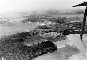 Vue aérienne d'Andir
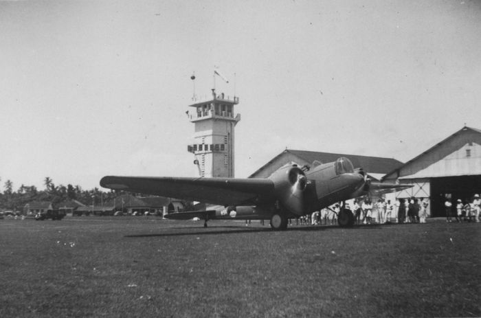
 Bombardier Martin B-10 de l'aviation militaire de l'armée royale des Indes néerlandaises à Andir (1937)
Terminal
Husein Sastranegara has one terminal that used for domestic and international flight. The area of terminal is 2.411,85 m2 and has three floors. Terminal 2 is being developed. Waiting room has capacity 500 peoples, currently the airport can handle about 2.500 passengers per day[5]. Passengers can also enjoy facilities of two executive lounges, internet, TV, Mushollah, restaurants, shops and ATM.
Future airport to be built
The Governor of West Java announced that there will be new airport built to replace Husein Sastranegara International Airport, named Bandung Majalengka International Airport. It would be located in Kertajati, Kabupaten de Majalengka, some 100 kilometers east of Bandung.
Compagnies et destinations
As a fast-growing small-sized international airport, destinations and schedule is changing rapidly[6]. Comprehensive departure and arrival schedule is being developed.
The following destinations are served from Husein Sastranegara International Airport:
Vols intérieurs
Indonesia AirAsia Denpasar, Medan Aviastar Palembang, Musirawas Merpati Nusantara Airlines Batam, Surabaya, Semarang, Makassar Sriwijaya Air Surabaya Susi Air Jakarta Halim Perdanakusuma, Pangandaran[7] Wings Air Surabaya, Yogyakarta Vols internationaux
Air Asia Kuala Lumpur Indonesia AirAsia Kuala Lumpur, Singapore Malaysia Airlines Kuala Lumpur Ground transportation
Information about the airport, destinations and schedule can be found here[6].
The airport is located at the end of Pajajaran Street. 5 km north-west from the city center, 3 km from train station. Taxi and public transport are widely available.
There are several route of public transport (called Angkot) pass the airport (You can ride it at Jl. Pajajaran) [8].
Most hotel in Bandung also provide a free airport transfer service.
Car rental also available.The airport also has 9.150m2 car park, and can accommodate up to 100 cars[9]
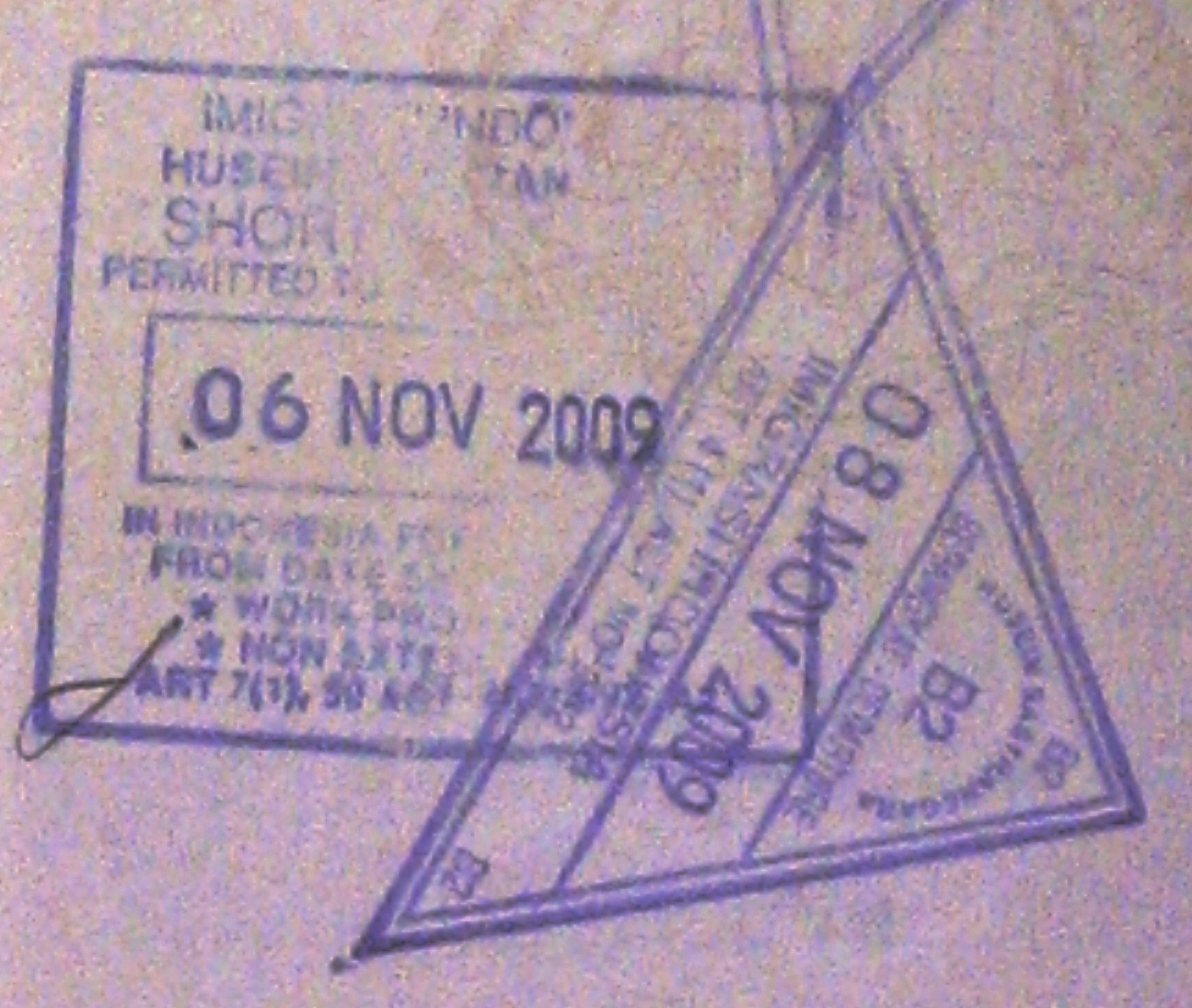
 Passport stamps from airport.
Accidents et incidents
- Le 6 avril 2009, un Fokker F-27 de l'armée de l'air indonésienne s'est écrasé à l'atterrissage et a heurté le hangar D de PT Dirgantara Indonesia (Indonesian Aerospace), killing all 24 people on board. This crash was caused by bad weather.
- Le 16 avril 2009, le vol Merpati Nusantara Airlines MZ-616 en route pour Surabaya (Java Est) et Denpasar (Bali) échoua à décoller après une course de 400 mètres et retourna sur l'aire de stationnement. Il n'y eut pas de victime.
Principaux autres aéroports d'Indonésie
- Aéroport international de Denpasar
- Aéroport international de Jakarta
- Aéroport international de Makassar
- Aéroport international de Medan
- Aéroport international de Padang
- Aéroport international de Surabaya
- Aéroport international de Yogyakarta
Notes
Catégorie :- Aéroport indonésien

Wikimedia Foundation. 2010.