Bad Kötzting

Bad Kötzting
Bad Kötzting
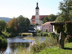
Image illustrative de l'article Bad Kötzting
L’église et le pont
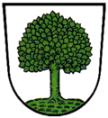
Blason de Bad Kötzting
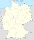
Germany location map.svg
Bad Kötzting
Administration
Toponyme officiel Bad Kötzting
Pays Drapeau d'Allemagne Allemagne
Land Bavière
District
(Regierungsbezirk)
Haut-Palatinat
Arrondissement
(Landkreis)
Cham
Code communal
(Gemeindeschlüssel)
09 3 72 137
Code postal 93444
Indicatif téléphonique 0 99 41
Immatriculation CHA
Site web www.bad-koetzting.de
Politique (2001-2006)
Bourgmestre
(Bürgermeister)
Wolfgang Ludwig
Partis au pouvoir CSU
Géographie
Coordonnées 49° 10′ 37″ N 12° 51′ 18″ E / 49.176944, 12.85549° 10′ 37″ Nord
       12° 51′ 18″ Est
/ 49.176944, 12.855
  
Altitude (NN) 409 m
Superficie 62,17 km2
Démographie
Population 7323 hab. (31 décembre 2009)
Densité 118 hab./km2

Bad Kötzting est une ville d’Allemagne située dans l’ouest du Land de Bavière, à la frontière de la République tchèque dans l’arrondissement de Cham, à environ 100 kilomètres de Ratisbonne.


Sur les autres projets Wikimedia :


Wikimedia Foundation. 2010.

Contenu soumis à la licence CC-BY-SA. Source : Article Bad Kötzting de Wikipédia en français (auteurs)

Игры ⚽ Нужно сделать НИР?

Regardez d'autres dictionnaires:

  • Bad Kotzting — Bad Kötzting Demande de traduction Bad Kötzting → …   Wikipédia en Français

  • Bad Kötzting — Wappen Deutschlandkarte …   Deutsch Wikipedia

  • Bad Kötzting — Infobox Ort in Deutschland Art = Stadt Wappen = Wappen Koetzting.png lat deg = 49 |lat min = 10 |lat sec = 37 lon deg = 12 |lon min = 51 |lon sec = 18 Lageplan = Bundesland = Bayern Regierungsbezirk = Oberpfalz Landkreis = Cham Höhe = 409 Fläche …   Wikipedia

  • 1. FC Bad Kötzting — Voller Name 1. Fußball Club Bad Kötzting 1921 e. V. Ort Bad Kötzting …   Deutsch Wikipedia

  • 1. FC Bad Kötzting — Football club infobox clubname = 1. FC Bad Kötzting fullname = 1. FC Bad Kötzting 1921 e.V. nickname = founded = 1921 ground = Roten Steg capacity = 6,000 chairman = Gerhard Schröder manager = Hans Kuchler league = Oberliga Bayern (V) season =… …   Wikipedia

  • Benedikt-Stattler-Gymnasium Bad Kötzting — Schulform Gymnasium (naturwissenschaftlich technologisch un …   Deutsch Wikipedia

  • Kötzting — Wappen Deutschlandkarte …   Deutsch Wikipedia

  • 1. FC Kötzting — 1. FC Bad Kötzting Voller Name 1. Fußball Club Bad Kötzting 1921 e.V. Gegründet 5. Mai 1921 Stadion …   Deutsch Wikipedia

  • AG Lokalbahn Lam-Kötzting — Cham–Lam Kursbuchstrecke (DB): 877 Streckennummer: 5811 (Cham–Bad Kötzting), 9580 (Bad Kötzting–Lam) Streckenlänge: 40,4 km Spurweite: 1435 mm (Normalspur) Legende …   Deutsch Wikipedia

  • Liste der Orte mit Namenszusatz „Bad“ — Die Liste enthält die Orte mit dem Namenszusatz „Bad“ mit der Angabe des Jahres der Verleihung. Inhaltsverzeichnis 1 Deutschland 1.1 Baden Württemberg 1.2 Bayern 1.3 Brandenburg …   Deutsch Wikipedia

Share the article and excerpts

Direct link
Do a right-click on the link above
and select “Copy Link”