Uitgeest
- Uitgeest
-
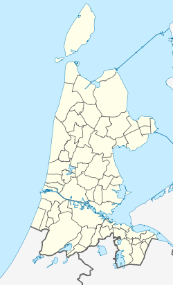
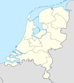
Uitgeest  est un village et une commune néerlandaise de Hollande-Septentrionale.
La commune est constituée des villes ou villages de Assum, Busch en Dam, Groot Dorregeest, Uitgeest.
Cinq moulins à vent peuvent être vu dans le polder autour du village. Cornelis Corneliszoon, qui fut l'inventeur de la scierie fonctionnant grâce au vent, est natif de Uitgeest.
Le village possède une église réformée datant du XIVe siècle. On peut également voir le fort « aan den Ham » (entre Uitgeest et Krommenie) qui faisait partie de la ligne de défense d'Amsterdam. Il a été transformé en musée.
Le cartographe Willem Blaeu (° 1571, † 1638) est natif de Uitgeest.
Lien externe
(nl) Site de la commune
Catégories :
- Localité de la Hollande-Septentrionale
- Commune de la Hollande-Septentrionale
Wikimedia Foundation.
2010.
Contenu soumis à la licence CC-BY-SA. Source : Article Uitgeest de Wikipédia en français (auteurs)
Regardez d'autres dictionnaires:
Uitgeest — Gemeinde Uitgeest Flagge Wappen Provinz Nordholland Bürgermeister … Deutsch Wikipedia
Uitgeest — Infobox Settlement official name = Uitgeest mapsize = 280px flag size = 150x75px image shield = Uitgeest wapen.png shield size = 150x75px subdivision type = Country subdivision name = Netherlands subdivision type1 = Province subdivision name1 =… … Wikipedia
Uitgeest — Original name in latin Uitgeest Name in other language Uitgeest State code NL Continent/City Europe/Amsterdam longitude 52.52917 latitude 4.70972 altitude 1 Population 11794 Date 2007 06 03 … Cities with a population over 1000 database
Uitgeest — Sp Etgestas Ap Uitgeest L Nyderlandai … Pasaulio vietovardžiai. Internetinė duomenų bazė
Uitgeest — Sp Etgestas Ap Uitgeest L Olandija … Pasaulio vietovardžiai. Internetinė duomenų bazė
Uitgeest railway station — Infobox NS station station = Station Uitgeest stationsnaam = Uitgeest latdeg=52 |latmin=31 |latsec=19 |londeg=4 |lonmin=42 |lonsec=10 positiekaartnaam=Randstad NUitgeest is a railway station located in Uitgeest and the village of Assum, the… … Wikipedia
Bahnhof Uitgeest — Uitgeest Daten Betriebsart Durchgangsbahnhof Bahnsteiggleise … Deutsch Wikipedia
Cornelis Corneliszoon van Uitgeest — 18th century allegorical print commemorating C.C. van Uitgeest s invention of the saw mill. Cornelis Corneliszoon van Uitgeest, or Krelis Lootjes (c. 1550 c. 1600) was a Dutch windmill owner from Uitgeest who invented the wind powered sawmill,… … Wikipedia
Bahnstrecke Haarlem–Uitgeest — Haarlem–Uitgeest Streckenlänge: 18 km Spurweite: 1435 mm (Normalspur) Stromsystem: 1.500 V … Deutsch Wikipedia
Gemeente Uitgeest — Admin ASC 2 Code Orig. name Gemeente Uitgeest Country and Admin Code NL.07.0450 NL … World countries Adminstrative division ASC I-II

 Pays-Bas