Prépotin

Prépotin

48° 36′ 52″ N 0° 34′ 42″ E / 48.6144444444, 0.578333333333

Prépotin
Administration
Pays France
Région Basse-Normandie
Département Orne
Arrondissement Mortagne-au-Perche
Canton Tourouvre
Code commune 61338
Code postal 61190
Maire
Mandat en cours
Bernard Colin
2008-2014
Intercommunalité Communauté de communes du Haut-Perche
Démographie
Population 115 hab. (2008)
Densité 11 hab./km²
Gentilé Prépotinois
Géographie
Coordonnées 48° 36′ 52″ Nord
       0° 34′ 42″ Est
/ 48.6144444444, 0.578333333333
Altitudes mini. 244 m — maxi. 304 m
Superficie 10,53 km2

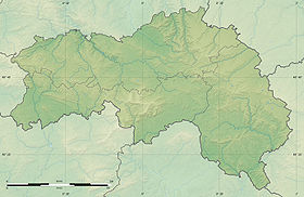
Voir la carte physique

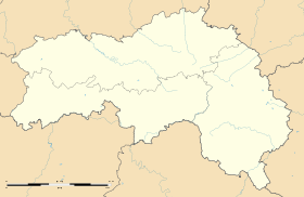
Voir la carte administrative

Prépotin est une commune française, située dans le département de l'Orne et la région Basse-Normandie, peuplée de 115 habitants[1] (les Prépotinois).

Sommaire

Géographie

Histoire

Administration

Liste des maires successifs
Période Identité Étiquette Qualité
juin 1995 mars 2008 Raymonde Boulanger    
mars 2008 en cours Bernard Colin SE Gérant de société
Toutes les données ne sont pas encore connues.

Démographie

Prépotin a compté jusqu'à 343 habitants en 1841.

Évolution démographique
(Source : Insee[3])
1962 1968 1975 1982 1990 1999 2008
120 93 56 70 77 95 115
Nombre retenu à partir de 1962 : population sans doubles comptes

Économie

Lieux et monuments

  • Église Saint-Jacques.
  • Forêt de la Trappe, forêt du Perche.
  • Nombreux étangs (étang Dais, étang Neuf, étang Robin…).

Activité et manifestations

Personnalités liées à la commune

Voir aussi

Notes et références

Altitudes, coordonnées, superficie : IGN[4].

Liens externes


Wikimedia Foundation. 2010.

Contenu soumis à la licence CC-BY-SA. Source : Article Prépotin de Wikipédia en français (auteurs)

Игры ⚽ Нужно решить контрольную?

Regardez d'autres dictionnaires:

  • Prepotin — Prépotin Prépotin Administration Pays France Région Basse Normandie Département Orne Arrondissement Mortagne au Perche Canton Tour …   Wikipédia en Français

  • Prépotin — Saltar a navegación, búsqueda Prépotin País …   Wikipedia Español

  • Prépotin — is a village and commune in the Orne département of north western France.ee also*Communes of the Orne department …   Wikipedia

  • Communaute de communes du Haut-Perche — Communauté de communes du Haut Perche Communauté de communes du Haut Perche Ajouter une image Administration Pays France Région Basse Normandie Département Orne Date de création 28 décembre 1995 …   Wikipédia en Français

  • Communauté De Communes Du Haut-Perche — Ajouter une image Administration Pays France Région Basse Normandie Département Orne Date de création 28 décembre 1995 …   Wikipédia en Français

  • Communauté de communes du Haut-Perche — Ajouter une image Administration Pays France Région Basse Normandie Département Orne Date de création 28 décembre 1995 Président Gu …   Wikipédia en Français

  • Communauté de communes du haut-perche — Ajouter une image Administration Pays France Région Basse Normandie Département Orne Date de création 28 décembre 1995 …   Wikipédia en Français

  • Alençon — Town hall of Alençon …   Wikipedia

  • Communes of the Orne department — The following is a list of the 505 communes of the Orne département, in France. Legend for tables: (CUA) Communauté urbaine of Alençon, created in 1996, also partly in the Sarthe département. (CAF) Communauté d agglomération of Pays de Flers,… …   Wikipedia

  • Marcei — Marcei …   Wikipedia

Share the article and excerpts

Direct link
Do a right-click on the link above
and select “Copy Link”