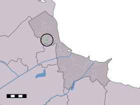
Krewerd
- Krewerd
-
53°21′14″N 6°50′56″E / 53.35389, 6.84889
Krewerd est un village néerlandais située dans la commune de Delfzijl dans la province de Groningue. Le village est situé au sud-ouest de Holwierde, entre Delfzijl et l'Eemshaven.
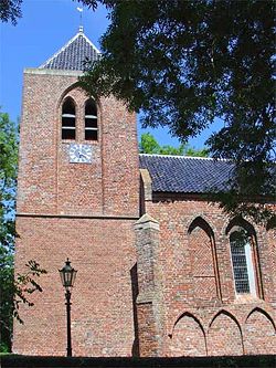
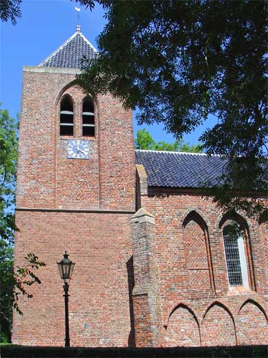
L'église Notre-Dame de Krewerd
Le village possède une église dédiée à Notre-Dame. Elle est construite au XIIIe siècle. Son clocher date du XVe siècle. Son orgue compte parmi les plus anciens des Pays-Bas (1531).
En 1840, le village comptait 17 maisons et 85 habitants[1]. Jusqu'en 1990, Krewerd faisait partie de la commune de Bierum.
Références
- ↑ Alphabetisch register van alle bewoonde oorden des Rijks, Departement van Oorlog, Éd. Erven Doorman, 's-Gravenhage, 1850
Wikimedia Foundation.
2010.
Contenu soumis à la licence CC-BY-SA. Source : Article Krewerd de Wikipédia en français (auteurs)
Regardez d'autres dictionnaires:
Krewerd — Dutch town locator maps mun town caption = Krewerd in the municipality of Delfzijl.Krewerd (coord|53|21|N|6|51|E|type:city(100)) is a town in the Dutch province of Groningen. It is a part of the municipality of Delfzijl, and lies about 24 km… … Wikipedia
Klaas Bolt — Klaas Roelof Bolt (* 6. März 1927 in Appingedam; † 11. April 1990 in Haarlem) war ein niederländischer Organist, Improvisator und Orgelsachverständiger. Er übte maßgeblich Einfluss auf die Orgelrenovierungs und Orgelbaupraxis in den Niederlanden… … Deutsch Wikipedia
Delfzijl — Municipality Flag … Wikipedia
Bierum — Administration Pays Pays Bas Province Groningue Commune … Wikipédia en Français
List of places in the Netherlands — This is an alphabetical list of places (cities, towns, villages) in the Netherlands. Lists per province can be found at:* List of towns in Groningen * List of towns in Friesland * List of towns in Drente * List of towns in Overijssel * List of… … Wikipedia
Meedhuizen — Town … Wikipedia
Bierum — Dutch town locator maps mun town caption = The village centre (dark green) and the statistical district (light green) of Bierum in the municipality of Delfzijl.Bierum (coord|53|23|N|6|52|E|type:city(610)) is a village in the Dutch province of… … Wikipedia
Delfzijl — Gemeinde Delfzijl Flagge Wappen Provinz Groningen Bürgermeister … Deutsch Wikipedia
Biessum — 53°20′3″N 6°53′51″E / 53.33417, 6.8975 … Wikipédia en Français
Borgsweer — 53°17′53″N 7°0′51″E / 53.29806, 7.01417 … Wikipédia en Français
 Pays-Bas