Termunterzijl
- Termunterzijl
-
53°18′3″N 7°2′3″E / 53.30083, 7.03417
Termunten est un village néerlandais située dans la commune de Delfzijl dans la province de Groningue. Le village est situé au sud-est de Delfzijl, sur l'Ems.
Le village s'est formé autour de l'écluse construite en 1601 dans le Termunterzijldiep. À la fin de l'Empire français, Termunterzijl avait un certain intérêt militaire, car le village hébergea une batterie qui a servi dans le Siège de Delfzijl. Au milieu du XIXe siècle, le village était un centre de pêche et de commerce, stimulé par la navigation commerciale liée aux défrichements des anciens marais de Groningue et Drenthe. En 1840, le village comptait 50 maisons et 340 habitants[1].
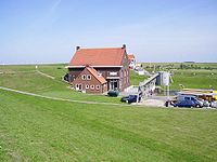
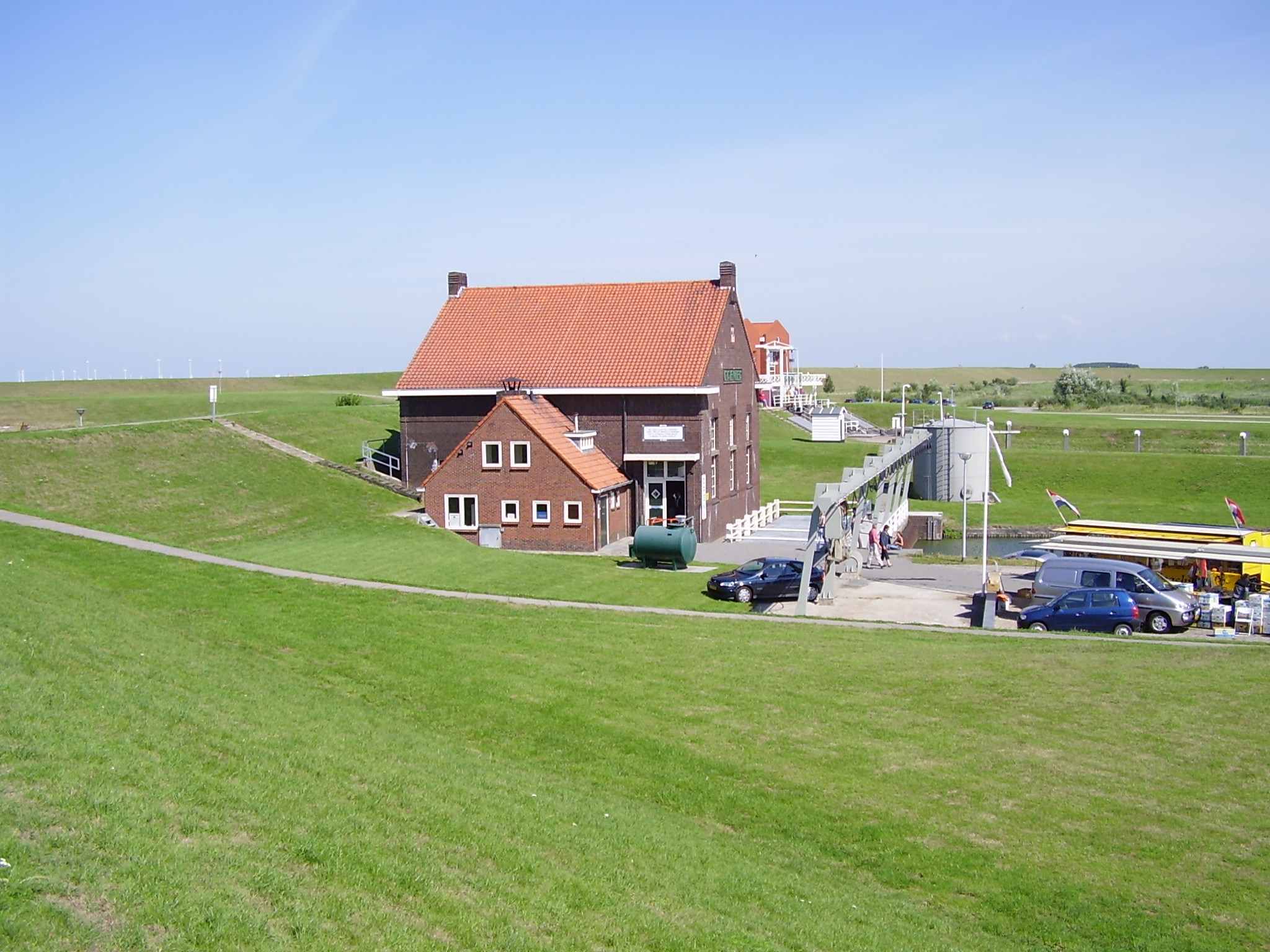
Station de pompage Cremer
.
Jusqu'en 1990, Termunterzijl faisait partie de la commune de Termunten. De nos jours, le port de Termunterzijl est surtout important pour la plaisance. Le centre de Termunterzijl a un statut d'ensemble de monuments historiques protégé
Références & source
- ↑ Alphabetisch register van alle bewoonde oorden des Rijks, Departement van Oorlog, Éd. Erven Doorman, 's-Gravenhage, 1850
Wikimedia Foundation.
2010.
Contenu soumis à la licence CC-BY-SA. Source : Article Termunterzijl de Wikipédia en français (auteurs)
Regardez d'autres dictionnaires:
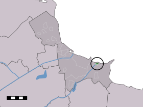
Termunterzijl — Dutch town locator maps mun town caption = The town centre (dark green) and the statistical district (light green) of Termunterzijl in the municipality of Delfzijl.Termunterzijl (coord|53|18|N|7|2|E|type:city(63)) is a town in the Dutch province… … Wikipedia
Termunten — Wappen von Termunten Termunten ist ein niederländischer Küstenort mit weniger als 1000 Einwohnern in der Provinz Groningen. Der Ort liegt etwa 8 Kilometer südöstlich der Stadt Delfzijl und 30 Kilometer nordöstlich von Groningen an der Mündung der … Deutsch Wikipedia
Termunterzijldiep — Caractéristiques Statut actuel Ouvert à la plaisance Histoire Année début travaux 1601 Commanditaire Termunterzijlvest Géographie Début … Wikipédia en Français
Delfzijl — Municipality Flag … Wikipedia
Delfzijl — Gemeinde Delfzijl Flagge Wappen Provinz Groningen Bürgermeister … Deutsch Wikipedia
List of places in the Netherlands — This is an alphabetical list of places (cities, towns, villages) in the Netherlands. Lists per province can be found at:* List of towns in Groningen * List of towns in Friesland * List of towns in Drente * List of towns in Overijssel * List of… … Wikipedia
Church architecture — The 800 year old Church of Termunterzijl in the north of the Netherlands See also: Architecture of cathedrals and great churches Church architecture refers to the architecture of buildings of Christian churches. It has evolved over the two… … Wikipedia
Royal Westminster Regiment — Infobox Military Unit unit name=The Royal Westminster Regiment caption= dates=01 April 1910 Present country=Canada branch=Militia command structure=Royal Canadian Infantry Corps type=Line Infantry role=Light Infantry ceremonial chief=The Duke of… … Wikipedia
Meedhuizen — Town … Wikipedia
Dollardroute — Logo der Internationalen Dollard Route Die Internationale Dollard Route ist ein ca. 206 km langer Rundkurs für Radfahrer. Sie führt durch die deutschen Landkreise Leer und Emsland und durch die niederländische Provinz Groningen. Sie besteht seit… … Deutsch Wikipedia
 Pays-Bas