- Čerhov
-
Čerhov
(Village)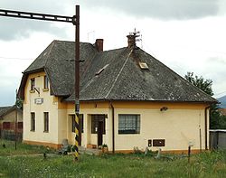
GareAdministration Pays  Slovaquie
Région Région de Košice District District de Trebišov Code postal 076 81 Plaque minéralogique TV Starosta (maire) Pavol Balogh ( Indépendant )
Mandat: 2013
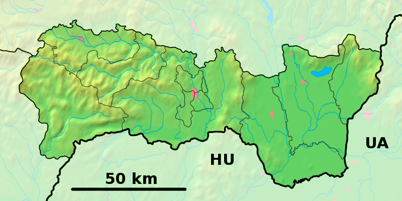
Démographie Population 813 hab. (31.12.2007) Densité 95,3 hab./km2 Géographie Coordonnées Altitude 129 m Superficie 852,8 ha = 8,528 km² Localisation en Slovaquie 
 Čerhov
 Čerhov
Localisation dans la région de Košice Internet Site de la commune http://www.cerhov.sk Sources Resultat des élections http://www.e-obce.sk [1] http://www.statistics.sk [2] Čerhov (allemand : Tschergau ,hongrois : Csörgő) est un village de Slovaquie situé dans la région de Košice.
Sommaire
Histoire
Première mention écrite du village en 1329.
La localité fut annexée par la Hongrie après le premier arbitrage de Vienne le 2 novembre 1938. En 1938, on comptait 567 habitants dont 29 d'origine juive. Elle faisait partie du district de Sátoraljaújhely (hongrois : Sátoraljaújhelyi járás). Le nom de la localité avant la Seconde Guerre mondiale était Čergov. Durant la période 1938 -1945, le nom hongrois Csörgő était d'usage[3]. À la libération, la commune a été réintégré dans la Tchécoslovaquie reconstituée.
Le village a subi ses plus importantes inondations depuis 1953 le 16 mai 2010[4].
Économie
Le village est l'un des 7 villages slovaques faisant partie de la région viticole Tokay.
Transport
Le village possède une gare sur la ligne de chemin de fer 190 entre Košice et Čierna nad Tisou.
Notes et références
- e-obce.sk
- Mestská a obecná štatistika SR
- Osudy slovenských Židov
- http://korzar.sme.sk/c/5377383/trebisovsky-okres-hlasi-mimoriadnu-situaciu-voda-zaliala-domy.html (sk) Trebišovský okres hlási mimoriadnu situáciu. Voda zaliala domy
Catégories :- Village de Slovaquie
- Village et ville du district de Trebišov


Wikimedia Foundation. 2010.