Bensekrane
- Bensekrane
-
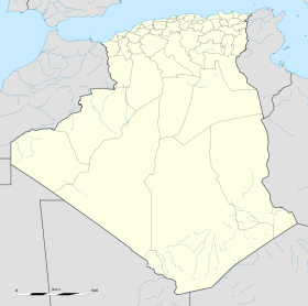
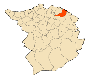
Bensekrane est une commune de la wilaya de Tlemcen en Algérie, située à mi-chemin entre la ville d'Aïn-temouchent et de Tlemcen (à peu près 30 km pour accéder à ces deux villes depuis Bensekrane).
A l'époque française la ville portait le nom de Pont de l'Isser.
Géographie
Situation
Cette section est vide, insuffisamment détaillée ou incomplète.
Votre aide est la bienvenue !
Localités de la commune
Cette section est vide, insuffisamment détaillée ou incomplète.
Votre aide est la bienvenue !
Histoire
Cette section est vide, insuffisamment détaillée ou incomplète.
Votre aide est la bienvenue !
Notes et références
Wikimedia Foundation.
2010.
Contenu soumis à la licence CC-BY-SA. Source : Article Bensekrane de Wikipédia en français (auteurs)
Regardez d'autres dictionnaires:
Bensekrane — Original name in latin Bensekrane Name in other language Ben Sokrane, Bensekrane, Pont de l Isser, Pont de l’Isser State code DZ Continent/City Africa/Algiers longitude 35.07465 latitude 1.22431 altitude 244 Population 21283 Date 2012 01 19 … Cities with a population over 1000 database
Bensekrane District — Infobox Algerian District map1 = DZ 13.svg map2 = name1 = Bensekrane name2 = Tlemcen province = Tlemcen capital = Bensekrane municipalities = code = chef = order = area1 = area2 = population = popyear = 2005 density1 = density2 = |Bensekrane… … Wikipedia
Daïra de Bensekrane — Localisation de la daïra dans la Wilaya de Tlemcen Administration Pays … Wikipédia en Français
Maghnia — Coordinates: 34°50′N 1°43′W / 34.833°N 1.717°W / 34.833; 1.717 Maghnia (Arabic: مغنية) (formerly … Wikipedia
Nedroma — (Arabic: ندرومة) is a city in Tlemcen Province, Algeria. Once the capital of Trara, it was built on the ruins of a Berber city by Abd al Mu min The Almohad caliph, who himself was a native of the neighboring mountains[1]. World Heritage Status… … Wikipedia
Maghnia District — دائرة مغنية District Map of Algeria highlighting Tlemcen Province … Wikipedia
Nedroma District — دائرة Tlemcen District Map of Algeria highlighting Tlemcen Province … Wikipedia
Mansourah District (Tlemcen Province) — Mansourah District دائرة Tlemcen District Map of Algeria highlighting Tlemcen Province … Wikipedia
Ouled Mimoun District — دائرة Tlemcen District Map of Algeria highlighting Tlemcen Province … Wikipedia
Chatouane District — دائرة Tlemcen District Map of Algeria highlighting Tlemcen Province … Wikipedia
 Algérie