Arevut

Arevut

40° 22′ 00″ N 43° 47′ 00″ E / 40.366667, 43.783333

Arevut
Արևուտ
Administration
Pays Drapeau d'Arménie Arménie
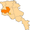
Région Aragatsotn
Maire Fayzo Amoyan[1]
(2008)
Géographie
Coordonnées 40° 22′ 00″ Nord
       43° 47′ 00″ Est
/ 40.366667, 43.783333
Superficie 1 301 ha = 13,01 km2
Démographie
Population 135 hab.
Densité 10,4 hab./km2
Localisation
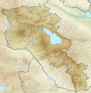
Voir la carte topographique
Arevut
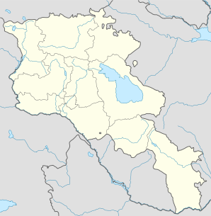
Voir la carte administrative
Arevut

Arevut (en arménien Արևուտ ; jusqu'en 1935 Duzkend puis Baroj[2]) est une communauté rurale du marz d'Aragatsotn, en Arménie. Elle compte 135 habitants en 2009[3].

Notes et références

  1. (hy+en) Central Electoral Commission of the Republic of Armenia. Consulté le 24 janvier 2011.
    Pour obtenir la page en anglais, cliquez sur le drapeau arménien en haut à gauche, et sélectionnez « English » ; ensuite, dans le menu vertical de gauche, cliquez sur « Local », sélectionnez le marz pertinent, puis la dernière élection correspondant à la communauté voulue.
  2. (en) Brady Kiesling, Rediscovering Armenia, 2000, p. 20  [lire en ligne (page consultée le 25 mars 2010)] .
  3. (en) ArmStat, Marzes of the Republic of Armenia in figures, « RA Aragatsotn Marz », 2009. Consulté le 23 novembre 2009.

Wikimedia Foundation. 2010.

Contenu soumis à la licence CC-BY-SA. Source : Article Arevut de Wikipédia en français (auteurs)

Игры ⚽ Нужна курсовая?

Regardez d'autres dictionnaires:

  • SURETYSHIP — (Heb. עַרְבוּת), one person s undertaking to fulfill the obligation of another toward a third person (called the arev, ḥayyav, and nosheh, respectively). In Jewish law fulfillment of an obligation is secured primarily through the assets of the… …   Encyclopedia of Judaism

  • AJ6 — is a Jewish organisation open to all Jews in years 11 13 in the UK. It was founded in 1977.AJ6 is peer led and has its own constitution. Until 2007, It ran both a membership side and a services side, the latter covering schools and campus.… …   Wikipedia

  • Achtarak — 40° 17′ 36″ N 44° 21′ 15″ E / 40.293396, 44.354249 …   Wikipédia en Français

  • Aghdsk — 40° 18′ 59″ N 44° 15′ 13″ E / 40.316389, 44.253611 …   Wikipédia en Français

  • Aparan — 40° 35′ 20″ N 44° 21′ 25″ E / 40.589, 44.357 …   Wikipédia en Français

  • Aragatsotn — 40°25′0″N 44°10′0″E / 40.41667, 44.16667 …   Wikipédia en Français

  • Byurakan — 40° 20′ 24″ N 44° 16′ 13″ E / 40.34, 44.270278 …   Wikipédia en Français

  • Kosh — 40° 18′ 09″ N 44° 09′ 25″ E / 40.3025, 44.156944 …   Wikipédia en Français

  • Ochakan — 40° 15′ 48″ N 44° 18′ 53″ E / 40.263333, 44.314722 …   Wikipédia en Français

  • Talin —  Pour l’article homophone, voir Tallinn. 40° 22′ 59″ N 43° 52′ 23″ E / …   Wikipédia en Français

Share the article and excerpts

Direct link
Do a right-click on the link above
and select “Copy Link”