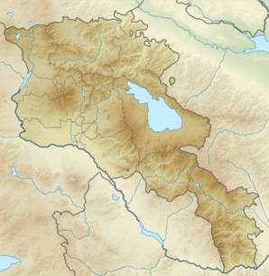
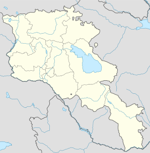
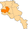
Orgov
- Orgov
-
40° 20′ 52″ N 44° 15′ 09″ E / 40.347778, 44.2525
Orgov (en arménien Օրգով) est une communauté rurale du marz d'Aragatsotn, en Arménie. Elle compte 551 habitants en 2009[2].
Notes et références
- ↑ (hy+en) Central Electoral Commission of the Republic of Armenia. Consulté le 24 janvier 2011.
Pour obtenir la page en anglais, cliquez sur le drapeau arménien en haut à gauche, et sélectionnez « English » ; ensuite, dans le menu vertical de gauche, cliquez sur « Local », sélectionnez le
marz pertinent, puis la dernière élection correspondant à la communauté voulue.
- ↑ (en) ArmStat, Marzes of the Republic of Armenia in figures, « RA Aragatsotn Marz », 2009. Consulté le 19 novembre 2009.
Catégorie :
- Communauté rurale de l'Aragatsotn
Wikimedia Foundation.
2010.
Contenu soumis à la licence CC-BY-SA. Source : Article Orgov de Wikipédia en français (auteurs)
Regardez d'autres dictionnaires:
Orgov — Coordinates: 40°20′52″N 44°15′09″E / 40.34778°N 44.2525°E / 40.34778; 44.2525 … Wikipedia
Oregon Coast — Southward view from Ecola State Park, Northern Oregon Coast The Oregon Coast is a region of the U.S. state of Oregon. It runs generally north south along the Pacific Ocean, forming the western border of the state; the region is bounded to the… … Wikipedia
Land use in Oregon — Map of federal land ownership in Oregon Bureau of Indian Affairs … Wikipedia
Oregon Beach Bill — The Oregon Beach Bill (House Bill 1601, 1967) was a piece of landmark legislation in the U.S. state of Oregon, passed by the 1967 session of the Oregon Legislature. It established public ownership of land along the Oregon Coast from the water up… … Wikipedia
Oregon Bottle Bill — Carbonated beverage containers, like the plastic bottles shown here, are sold with refundable deposits. The Oregon Bottle Bill is container deposit legislation passed in the U.S. state of Oregon in 1971 and amended in 2007. It requires cans,… … Wikipedia
Oshakan — This article is about a town in Armenia. For the city in Japan, see Osaka. Oshakan Օշական Oshakan as seen from the western side of Didikond Hill … Wikipedia
Aparan — This article is about the town. For the Malayalam film, see Aparan (film). Aparan Panorama of Aparan with Mount Aragats on the right … Wikipedia
Alagyaz — For other places with the same name, see Alagyaz (disambiguation). Coordinates: 40°40′53″N 44°17′25″E / 40.68139°N 44.29028°E / 40.68139; 44.29028 … Wikipedia
Avshen — Coordinates: 40°43′33″N 44°17′30″E / 40.72583°N 44.29167°E / 40.72583; 44.29167 … Wikipedia
Chknagh — Coordinates: 40°35′03″N 44°26′02″E / 40.58417°N 44.43389°E / 40.58417; 44.43389 … Wikipedia
 Arménie


