Ujan
- Ujan
-
40° 17′ 54″ N 44° 12′ 17″ E / 40.2983333, 44.2047222 40° 17′ 54″ N 44° 12′ 17″ E / 40.2983333, 44.2047222
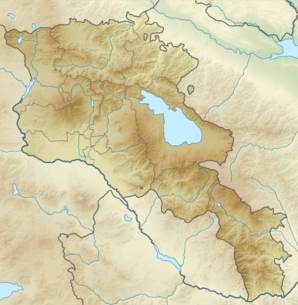
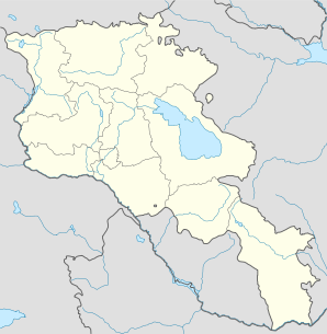
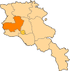
Ujan, Udzhan ou Udjan (en arménien Ուջան) est une communauté rurale du marz d'Aragatsotn en Arménie, à 30 km au nord-ouest d’Erevan et au pied du mont Aragats. Elle compte 3 475 en 2009[2].
Ujan a été une résidence d'été des Il-khans mongols aux XIIIe et XIVe siècles.
Ujan possède une statue du général Andranik, héros national arménien.
Notes et références
- ↑ (hy+en) Central Electoral Commission of the Republic of Armenia. Consulté le 24 janvier 2011.
Pour obtenir la page en anglais, cliquez sur le drapeau arménien en haut à gauche, et sélectionnez « English » ; ensuite, dans le menu vertical de gauche, cliquez sur « Local », sélectionnez le
marz pertinent, puis la dernière élection correspondant à la communauté voulue.
- ↑ (en) ArmStat, Marzes of the Republic of Armenia in figures, « RA Aragatsotn Marz », 2009. Consulté le 18 novembre 2009.
Catégorie :
- Communauté rurale de l'Aragatsotn
Wikimedia Foundation.
2010.
Contenu soumis à la licence CC-BY-SA. Source : Article Ujan de Wikipédia en français (auteurs)
Regardez d'autres dictionnaires:
Ujan — (en armenio: Ուջան, también romanizado como Udzhan y Udjan) es un municipio en la provincia de Aragatsotn en Armenia. Tiene una gran estatua del general Andranik Ozanian, un héroe nacional armenio. En 2008 tenía 2707 habitantes. Referencias… … Wikipedia Español
Ujan — Infobox Settlement official name =Ujan native name = pushpin mapsize =150px subdivision type = Country subdivision name = Armenia subdivision type1 = Marz (Province) subdivision name1 =Aragatsotn leader title = leader name = established title =… … Wikipedia
Ujan Bazaar — UZAN BAZAAR Uzan Bazaar is a residential cum commercial center of the city of Guwahati. It is located in the Northern part of the city with the river Brahmaputra flowing alongside. This area being the nearest of the residential areas as far as… … Wikipedia
Udzhan — Ujan 40° 17′ 54″ N 44° 12′ 17″ E / 40.2983333, 44.2047222 … Wikipédia en Français
Trishal Upazila — Infobox of upazilas native name = Trishal locator position = right latd = 24.5750 longd = 90.3917 division name = Dhaka Division district = Mymensingh District population as of = 1991 population total = 336797 population density = 994 area total … Wikipedia
Эйноддин — Деревня Эйноддин عینالدین Страна ИранИран … Википедия
Guwahati — Infobox Indian Jurisdiction native name=Guwahati skyline = Guwahati citysky.jpg skyline caption = A view of the city locator position=left latd = 26.17|longd=91.77 state name=Assam district=Kamrup leader title=Mayor leader name= Dolly Borah… … Wikipedia
Uchen script — Pögä ( Tibetan language ) written in ujän style. The head of the script is the horizontal line atop each character. Ujain (Tibetan: དབུ་ཅན།, Wylie: dbu can, ZYPY: ujän; IPA: … Wikipedia
Vergonha — Articleissues POV = January 2008 refimprove = May 2008 citecheck = June 2008 external links = June 2008 La vergonha (Occitan for shame, pronounced|beɾˈɣuɲɔ) is what some Occitans call the nefarious effects of various policies of the Government of … Wikipedia
Utschur — UtschurVorlage:Infobox Fluss/GKZ fehlt Lage Region Chabarowsk, Republik Sacha (Jakutien) (Russland)Vorlage:Infobox Fluss/FLUSSSYSTEM fehlt Vorlage:Infobox Fluss/ABFLUSSWEG fehlt Quelle St … Deutsch Wikipedia
 Arménie


