Zwartewaterland
- Zwartewaterland
-
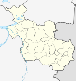
Zwartewaterland est une commune néerlandaise, en province d'Overijssel.
Localités
Baarlo, Cellemuiden, De Velde, Genemuiden, Hasselt, Kamperzeedijk-Oost, Kamperzeedijk-West, Kievitsnest, Mastenbroek (partiellement), Zwartewatersklooster et Zwartsluis.
Lien externe
(nl) Site officiel
Wikimedia Foundation.
2010.
Contenu soumis à la licence CC-BY-SA. Source : Article Zwartewaterland de Wikipédia en français (auteurs)
Regardez d'autres dictionnaires:
Zwartewaterland — Gemeinde Zwartewaterland Flagge Wappen Provinz Overijssel … Deutsch Wikipedia
Zwartewaterland — Infobox Settlement official name = Zwartewaterland mapsize = 280px subdivision type = Country subdivision name = Netherlands subdivision type1 = Province subdivision name1 = Overijssel area footnotes = (2006) area total km2 = 87.91 area land km2 … Wikipedia
Baarlo (Zwartewaterland) — 52°39′47″N 6°6′20″E / 52.66306, 6.10556 … Wikipédia en Français
Baarlo (Zwartewaterland) — Baarlo is a small village in the Dutch province of Overijssel. It is located in the municipality Zwartewaterland, about 4 km northeast of the town of Zwartsluis.The village lies on the Meppelerdiep canal between Zwartsluis and Meppel.Baarlo… … Wikipedia
Gemeente Zwartewaterland — Admin ASC 2 Code Orig. name Gemeente Zwartewaterland Country and Admin Code NL.15.1896 NL … World countries Adminstrative division ASC I-II
Hasselt (Niederlande) — Gemeinde Zwartewaterland Flagge Wappen Provinz … Deutsch Wikipedia
Liste der ehemaligen Gemeinden in Overijssel — Hierunter folgt eine Liste der ehemaligen overijsselschen Gemeinden. Wenn das Gebiet einer aufgehobenen Gemeinde über mehrere Gemeinden verteilt worden ist, ist das Großteil der erstgenannten Gemeinde hinzugefügt. Grenzkorrekturen zwischen… … Deutsch Wikipedia
Genemuiden — 52°37′28″N 6°2′23″E / 52.62444, 6.03972 … Wikipédia en Français
Hasselt (Overijssel) — 52°35′27″N 6°5′28″E / 52.59083, 6.09111 … Wikipédia en Français
Zwartsluis — 52°38′31″N 6°4′13″E / 52.64194, 6.07028 … Wikipédia en Français
 Pays-Bas


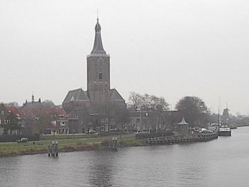
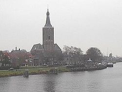 Hasselt, vu depuis le pont au-dessus de la Zwarte Water.