- Sidlaw
-
Sidlaw Hills
Sidlaw Hills 
Géographie Altitude 455 m, Craigowl Hill Massif Longueur 45 km Largeur km Superficie km2 Coordonnées Administration Pays  Royaume-Uni
Nation constitutive Écosse ' Géologie Âge Roches Roches volcaniques modifier 
Les Sidlaw Hills sont une chaîne de collines d'origine volcanique s'étendant dans les comtés de Perth et d'Angus en Écosse. Elles sont aussi appelées simplement The Sidlaw, law étant le mot scot, issu du vieil anglais, pour colline. L'élément sid est sans doute dérivé du gaélique écossais sidh, qui désigne l’Autre Monde dans la mythologie celtique ; en effet, de nombreux tumulus préhistoriques sont toujours visibles sur plusieurs sites, et la croyance populaire les tenait autrefois pour les résidences des Tuatha Dé Danann.
Sommaire
Description
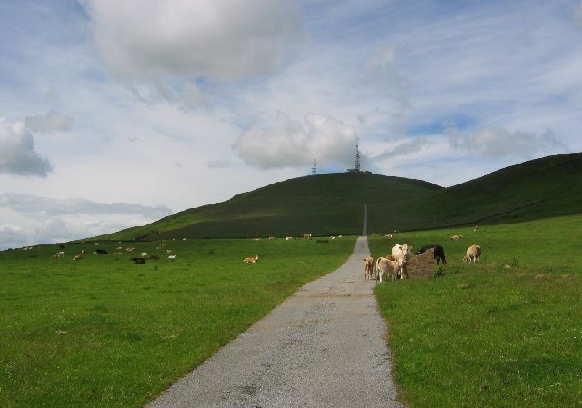
 Craigowl Hill
Les Sidlaw s'étendent sur environ 45 kilomètres entre Kinnoull Hill, près de Perth, jusqu'au nord-est de Forfar[1].
Le point culminant de la chaîne est Craigowl Hill ; c'est sur le sommet voisin de Gallow Hill qu'est construit l'émetteur transmettant la télévision et la radio à la région.
Les autres sommets d'importance sont Ark Hill et King's Seat.
Sites d'intérêt
Dunsinane Hill est mentionnée dans la pièce Macbeth de William Shakespeare, et sur Auchterhouse Hill s'élevait autrefois un fort militaire.
A proximité des Sidlaw se trouvent le château de Glamis et la pierre d'Eassie, une pierre picte gravée, en forme de croix, située dans une église en ruines du village d'Eassie[2]
Les Sidlaw en musique
Sidlaw Hills est le nom d'un Scottish composé pour le fiddle (violon) par Jim Watson[3], un musicien de Blairgowrie (1868 - 1931)
Références
- ↑ United Kingdom Ordnance Survey Map, Landranger (2005)
- ↑ (en) C.Michael Hogan, Eassie Stone, The Megalithic Portal, ed. Andy Burnham, Oct. 7, 2007
- ↑ [http://www.springthyme.co.uk/album05/05songtexts.html Tom Hughes and His Border Fiddle
- (en) Cet article est partiellement ou en totalité issu d’une traduction de l’article de Wikipédia en anglais intitulé « Sidlaw Hills ».
 Portail de l’Écosse
 Portail de la montagne
Catégories : Massif de montagne d'Europe | Montagne d'Écosse

Wikimedia Foundation. 2010.