Larkana
Contenu soumis à la licence CC-BY-SA. Source : Article Larkana de Wikipédia en français (auteurs)
Regardez d'autres dictionnaires:
Larkana — لاڑکانہ Staat: Pakistan Provinz … Deutsch Wikipedia
Lārkāna — Larkana 27°33′36″N 68°13′35″E / 27.56, 68.22639 … Wikipédia en Français
Larkana — لاڑکانہ … Wikipedia Español
Larkana — Infobox Settlement name = Larkana native name = Nastaliq|لاڙڪاڻو settlement type = City District |Soekarno Memorial Tower image blank emblem = blank emblem type = Emblem pushpin mapsize = 1500 subdivision type = Country subdivision name =… … Wikipedia
Lārkāna — ▪ Pakistan town and district, Sukkur division, Sindh province, Pakistan. The town, the district headquarters, lies on the Ghar Canal just west of the Indus River; it derives its name from the neighbouring Lārak tribe. A railway junction, it … Universalium
Larkana — Original name in latin Lrkna Name in other language Larkana, Larkane, Lrkna, Ларкане State code PK Continent/City Asia/Karachi longitude 27.55508 latitude 68.21414 altitude 54 Population 364033 Date 2012 01 17 … Cities with a population over 1000 database
Larkana Division — was an administrative division of the Sindh Province of Pakistan, until the reforms of 2000 abolished the third tier of government … Wikipedia
Larkana Taluka — Infobox Tehsil Pakistan tehsil caption = official name= Larkana province= Sindh district= Larkana District area total km2= census year= 1998 estimate year= census pop= estimate pop= population density km2= towns= uc= 18 nazim= Qurban Ali abbasi… … Wikipedia
Larkana District — Infobox Pakistan district district = Larkana District (Sindhi: ضلعو لاڙڪاڻو) area = 7,423 population = 1,927,066 pop year = 1998 density = 259.6 established = nazim = Muhammad Bux Arijo naib nazim = Syed Ali Raza tehsils = 04 languages = Sindhi,… … Wikipedia
Larkana District — Admin ASC 2 Code Orig. name Lārkāna District Country and Admin Code PK.05.1172127 PK … World countries Adminstrative division ASC I-II
 Pakistan
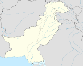
 Larkana