Lakhdenpokhya

Lakhdenpokhya

Lakhdenpokhia

Lakhdenpokhia
Лахденпохья
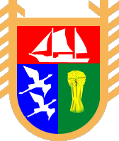
Coat of Arms of Lahdenpohja (Karelia).gif
[[Image:|300px|]]
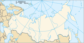
Blank map of Russia-geoloc.svg
Lakhdenpokhia
Pays Flag of Russia.svg Russie
Région économique Nord
District fédéral Nord-Ouest
Sujet fédéral Flag of Karelia.svg République de Carélie
Code OKATO 86 218 501
Maire Iouri Filimonov
Gouverneur
Fondation 1600
Statut ville depuis 1945
Ancien(s) nom(s) Sieklahti
Population Diminution 8 266 hab. (2008)
Densité 918 hab./km2
Gentilé
Altitude 10 m
Superficie 9 km2
Cours d'eau Aurajoki
Fuseau horaire UTC+3 (heure d'été : +4) Map of Russia - Moscow time zone.svg
Indicatif téléphonique (+7) 81450
Site officiel lahdenpohja.onego.ru
Commons [{{fullurl:Commons:Category:{{{commons}}}|uselang=fr}} Lakhdenpokhia] sur Commons
Liste des villes de Russie

Lakhdenpokhia (en russe : Лахденпохья ; en finnois : Lahdenpohja) est une ville de la république de Carélie, en Russie, et le centre administratif du raïon de Lakhdenpokhski. Sa population s'élève à 8 266 habitants en 2008.

Sommaire

Géographie

Lakhdenpokhia est située à 11,5 km de la rive nord-ouest du lac Ladoga, au fond d'une baie très étroite (Iakkimvaarski zaliv, en russe : Яккимваарский залив). Elle est arrosée par la rivière Aurajoki.

Lakhdenpokhia se trouve à 221 km (350 km par la route) à l'ouest de Petrozavodsk.

Histoire

Le territoire de Lakhdenpokhia appartenait initialement à la commune de Jakkima (en finnois : Jaakkima). En 1882, au fond de la baie de Sieklahti, fut établie une agglomération nommée Lahdenpohja, signifiant « la fin de la baie » en finnois. Avec l'accession de la Finlande à l'indépendance, en 1918, la localité fit partie de la province de Viipuri. En 1924, le bourg de Lahdenpohja se sépara définitivement de Jaakkima.

Après la guerre d'hiver de 1940, la majeure partie de la Carélie occidentale fut annexée par l'Union soviétique et incorporée à la République socialiste soviétique carélo-finnoise — à partir de 1956, République socialiste soviétique autonome de Carélie. Pendant la Seconde Guerre mondiale, Lahdenpohja fut à nouveau, dès le début de la guerre, occupée par les troupes finlandaises et en 1944 reprise par l'Armée rouge. Elle reçut le statut de ville en 1945.

Lakhdenpokhia dispose d'une gare ferroviaire sur la ligne Vyborg (Russie) – Joensuu (Finlande).

Population

Évolution démographique
1939 1959 1979 1989 2002 2008
1 959 7 800 9 500 10 400 8 751 8 266

Lien externe

Source


Armoiries de la république de Carélie Villes de la république de Carélie Drapeau de la république de Carélie
Capitale administrative : Petrozavodsk

Belomorsk • Kem • Kondopoga • Kostomoukcha • Lakhdenpokhia • Medvejiegorsk • Olonets • Pitkiaranta • Poudoj • Segueja • Sortavala • Souoïarvi

  • Portail de la Russie Portail de la Russie
Ce document provient de « Lakhdenpokhia ».

Wikimedia Foundation. 2010.

Contenu soumis à la licence CC-BY-SA. Source : Article Lakhdenpokhya de Wikipédia en français (auteurs)

Игры ⚽ Поможем написать реферат

Regardez d'autres dictionnaires:

  • Lakhdenpokhya — ( ru. Лахденпохья; fi. Lahdenpohja) is a town in the Republic of Karelia, Russia, located some 330 km west of Petrozavodsk on the Aurajoki River at coord|61|31|0|N|30|10|60|E, and a railway station of the Vyborg Joensuu railroad. Population:… …   Wikipedia

  • Гостиница Щучье Озеро — (Lakhdenpokhya,Россия) Категория отеля: Адрес: Малиновская Улица 2Б, Lakhdenp …   Каталог отелей

  • Lake Ladoga — Infobox lake lake name = Lake Ladoga image lake = Laadoga pkallas 2005.jpg caption lake = Northern shore image bathymetry = caption bathymetry = location = Northwestern Russia coords = coord|61|00|N|31|00|E|type:waterbody region:RU|display=inline …   Wikipedia

  • List of cities and towns in Russia — This is a list of cities and towns in Russia. According to the data of 2002 Russian Census, there are 1,108 cities and towns in Russia. City Russian name Federal subject Abakan Абакан Republic of Khakassia Abaza Абаза Republic of Khakassia… …   Wikipedia

  • Sortavala — Coordinates: 61°42′N 30°40′E / 61.7°N 30.667°E / 61.7; 30.667 …   Wikipedia

  • Administrative divisions of the Republic of Karelia — *Cities and towns under republic s jurisdiction: **Petrozavodsk (Петрозаводск) (capital) **Kostomuksha (Костомукша) ***with 1 rural administration under the town s jurisdiction. **Sortavala (Сортавала) *** Urban type settlements under the town s… …   Wikipedia

  • List of renamed cities and towns in Russia — Reasons for geographical renaming in Russia were *an especially large number of cities and towns were renamed in Russia after the October Revolution of 1917 *more renamings happened during the whole history of the Soviet Union due to political… …   Wikipedia

  • Olonets — (English) Олонец (Russian) Anuksenlinnu (Karelian) …   Wikipedia

  • Olonetsky District — (English) Олонецкий район (Russian) …   Wikipedia

  • Medvezhyegorsk — For other uses, see Karhumäki brothers. Medvezhyegorsk (English) Медвежьегорск (Russian) …   Wikipedia

Share the article and excerpts

Direct link
Do a right-click on the link above
and select “Copy Link”