Karislojo

Karislojo

Karjalohja

60° 14′ 24″ N 23° 43′ 00″ E / 60.24, 23.716667

Karjalohja
Pays
drapeau de la Finlande
     Finlande
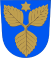
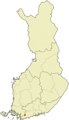
Blason de Karjalohja Localisation de Karjalohja en Finlande
Province historique Uusimaa
Province Finlande méridionale
Région Uusimaa
Fondée en 1614
Droits de Cité non
Langue officielle unilingue finnois
Altitudes minimale : 32 m
maximale : env 100 m
Superficie
dont eau
163.53 km²
40.73 km²
Rang
(Superficie hors eau)
375 e
Population

Rang population
1 476 hab.
(1.11.2006)
383 e
Densité 12 hab./km²

Karjalohja (Karislojo en suédois) est une municipalité du sud de la Finlande, dans la région d'Uusimaa et la province de Finlande méridionale.

Bien que rattachée à la région la plus dense et la plus peuplée du pays, à 70 km de la capitale Helsinki, c'est une petite commune rurale plutôt isolée. 25% de sa superficie est couverte par les lacs, un taux très élevé pour le sud. Ceci est du au fait qu'une bonne partie du grand lac Lohjanjärvi s'étend sur le territoire de la municipalité. Le paysage est accidenté, strié par les eskers et moraines appartenant au système du Salpausselkä.

La densité de maisons de vacances est très élevée, la petite commune en comptant pas loin de 1 700, proximité des grandes villes oblige.

Outre son paysage préservé, la commune ne présente pas de curiosité touristique majeure. Son église de pierre, incendiée dans les années 1970, n'est plus qu'une ruine fantômatique qui se dresse face à la nouvelle église.

Les communes voisines sont Sammatti au nord-est, Lohja à l'est, Karis au sud, Pohja au sud-ouest, et en Finlande du Sud-Ouest Kisko à l'ouest et Suomusjärvi au nord.

Liens externes


Blason d'Uusimaa Municipalités d'Uusimaa Drapeau de la Finlande

Ekenäs - Espoo - Hanko - Helsinki - Hyvinkää - Ingå - Järvenpää - Karis - Karjalohja - Karkkila - Kauniainen - Kerava - Kirkkonummi - Lohja - Mäntsälä - Nummi-Pusula - Nurmijärvi - Pohja - Pornainen - Sammatti - Siuntio - Tuusula - Vantaa - Vihti
Finlande méridionale | Finlande

  • Portail de la Finlande Portail de la Finlande
Ce document provient de « Karjalohja ».

Wikimedia Foundation. 2010.

Contenu soumis à la licence CC-BY-SA. Source : Article Karislojo de Wikipédia en français (auteurs)

Игры ⚽ Поможем написать курсовую

Regardez d'autres dictionnaires:

  • Karislojo — Karjalohjan kunta Wappen Karte Basisdaten …   Deutsch Wikipedia

  • List of Finnish municipalities — This is a listing in alphabetical order of the current municipalities in Finland as of 2008. For population see List of Finnish municipalities by population. Notice that if the place has both a Finnish and a Swedish name, the majority language is …   Wikipedia

  • List of Finnish municipalities by population — This is a list of the municipalities of Finland sorted by population as of 31st of December 2005:# Helsinki (Helsingfors) 560 905 {+0,3%} # Espoo (Esbo) 231 704 {+1,9%} # Tampere (Tammerfors) 204 337 {+0,7%} # Vantaa (Vanda) 187 281 {+1,0%} #… …   Wikipedia

  • List of Finnish municipalities by area — This is a list of the municipalities of Finland sorted by area as of 1st of January 2006:# 17333.38 km²: Inari (Enare) # 12415.26 km²: Sodankylä # 8391.54 km²: Enontekiö (Enontekis) # 8263.09 km²: Kittilä # 8017.20 km²: Rovaniemi # 6496.64 km²:… …   Wikipedia

  • Regions of Southern Finland — This article is part of the Subdivisions of Finland series Regions Sub regions Municipalities list list by population list by area NUTS:FI ISO 3166 2:FI The former Province of Southern Finland in Finland was divided into six regions, 16 sub… …   Wikipedia

  • Uusimaa — This article is about the contemporary region of Finland. For other uses of Uusimaa, see Uusimaa (disambiguation). Uusimaa – Nyland Uudenmaan maakunta Nylands landskap   Region   …   Wikipedia

  • Karjalohja — (pronounced|ˈkɑrjɑˌlohjɑ), or Karislojo in Swedish is a municipality of Finland.It is located in the province of Southern Finland and is part of the Uusimaa region. The municipality has a population of 1,491 (2004 12 31) and covers an area of 163 …   Wikipedia

  • Karjalohja — Karjalohjan kunta Wappen Karte Basisdaten Staat …   Deutsch Wikipedia

  • Karjalohja — Géographie Pays  Finlande Région Uusimaa Altitude   …   Wikipédia en Français

  • Uusimaa — 60°15′N 24°30′E / 60.25, 24.5 …   Wikipédia en Français

Share the article and excerpts

Direct link
Do a right-click on the link above
and select “Copy Link”