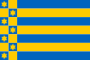
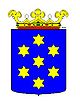
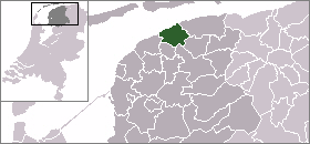
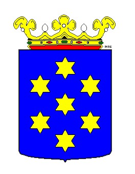
Ferwerderadeel
- Ferwerderadeel
-
Ferwerderadiel
Ferwerderadiel (en néerlandais, Ferwerderadeel), est une commune néerlandaise de la Frise. La langue officielle de la commune étant le frison, tous les villages de la commune portent officiellement un nom frison. Les noms néerlandais sont considérés comme des exonymes.
Lien externe
(de)(en)(fr)(nl) Site officiel
 Portail des Pays-Bas
Catégories : Ferwerderadiel | Commune de la Frise
Wikimedia Foundation.
2010.
Contenu soumis à la licence CC-BY-SA. Source : Article Ferwerderadeel de Wikipédia en français (auteurs)
Regardez d'autres dictionnaires:
Eastergoa — in the Frankish realm (in the Middle Ages Eastergoa (also Ostergau, Ostergo, or Oostergo) was one of the seven areas and one of the three gaue that lay within the borders of the today s Frisian province of Friesland in The Netherlands. Area On… … Wikipedia
Ferwerderadiel — Gemeinde Ferwerderadiel Flagge Wappen Provinz Friesland … Deutsch Wikipedia
Liste aller niederländischen Gemeinden A–L — In diese Liste werden alle Gemeinden, die auf dem Gebiet der jetzigen Niederlande bestehen oder bestanden haben, aufgenommen. Die Liste beginnt im Jahr 1805/10. Vor 1830 können die Angaben unvollständig sein. Kleinere Grenzkorrekturen oder… … Deutsch Wikipedia
Ferwerderadiel — Infobox Settlement official name = Ferwerderadiel image seal size = 70px mapsize = 280px subdivision type = Country subdivision name = Netherlands subdivision type1 = Province subdivision name1 = Friesland area footnotes = (2006) area total km2 … Wikipedia
Gerardus Heymans — (17 April 1857, Ferwerderadeel ndash; 18 February 1930, Groningen) was a famous philosopher, psychologist, a follower of Fechner s idea of psychic monism, and from 1890 to 1927 a Professor at Groningen University.His student Johannes Jacobus… … Wikipedia
Middelzee — 1834 map of the former Middelzee The Middelzee (Dutch for middle sea ; West Frisian: Middelsee), also called Bordine, was the estuary mouth of the River Boorn (West Frisian: Boarn) now in the Dutch province of Friesland. It ran from as far south… … Wikipedia
Grietenij — A grietenij was a forerunner to the gemeente or municipality in Frisia, particularly in Friesland, and also in Groningen which are now a part of the Netherlands. From the end of the 16th century until 1851, there were a total of 30 Grietenijen in … Wikipedia
Dokkumer Ee — Leeuwarderadeel, Dokkumer Ee Die Dokkumer Ee ist ein Fluss in Friesland zwischen den Städten Leeuwarden und Dokkum. Er quert die Gemeinden Leeuwarden, Leeuwarderadeel, Ferwerderadiel (Ferwerderadeel) und … Deutsch Wikipedia
Frise — Landkarte der Departements in der heutigen Benelux Region Frise (deutsch und niederländisch: Friesland, westfriesisch: Fryslân) ist ein ehemaliges französisches Département, das von 1810 bis 1814 bestand. Die niederländische Provinz Friesland… … Deutsch Wikipedia
Liste der ehemaligen Gemeinden in Friesland — Hierunter folgt eine Liste der ehemaligen friesischen Gemeinden. Wenn das Gebiet einer aufgehobenen Gemeinde über mehrere Gemeinden verteilt worden ist, ist das Großteil der erstgenannten Gemeinde hinzugefügt. Grenzkorrekturen zwischen erhaltenen … Deutsch Wikipedia