Smallingerland
- Smallingerland
-
Smallingerland est une commune néerlandaise de la Frise.
Lien externe
(en)(fy)(nl) Site officiel
|
|
| Hameaux et autres lieux |
Buitenstverlaat • Egbertsgaasten • De Gaasten • Galhoeke • De Kooi • Luchtenveld • Middelburen • Opperburen • Sytebuorren • Uiteinde • Wierren • Zandburen |
| Pays-Bas • Frise • Communes des Pays-Bas |
Wikimedia Foundation.
2010.
Contenu soumis à la licence CC-BY-SA. Source : Article Smallingerland de Wikipédia en français (auteurs)
Regardez d'autres dictionnaires:
Smallingerland — Smallingerland, Gemeinde in der niederländ. Provinz Friesland, Bezirk Heerenveen, besteht aus 6 Ortschaften mit (1904) 11,274 Einw. Hauptort ist der schöne Flecken Dragten (Drachten) mit Ackerbau, Viehzucht, Gerberei und Schiffbau … Meyers Großes Konversations-Lexikon
Smallingerland — Infobox Settlement official name = Smallingerland mapsize = 280px subdivision type = Country subdivision name = Netherlands subdivision type1 = Province subdivision name1 = Friesland area footnotes = (2006) area total km2 = 126.15 area land km2 … Wikipedia
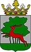
Smallingerland — Gemeinde Smallingerland Flagge Wappen Provinz Friesland … Deutsch Wikipedia
Smallingerland — Sp Smãlingerlandas Ap Smallingerland L Nyderlandai … Pasaulio vietovardžiai. Internetinė duomenų bazė
Smallingerland — Sp Smãlingerlandas Ap Smallingerland L Olandija … Pasaulio vietovardžiai. Internetinė duomenų bazė
Smallingerland — Smạllingerland, Gemeinde in der Provinz Friesland, Niederlande, 50 300 Einwohner; der Ortsteil Drachten, ein ehemaliges Torfstecherdorf, entwickelte sich zum Industriezentrum … Universal-Lexikon
Oudega (Smallingerland) — 53°7′30″N 5°59′57″E / 53.125, 5.99917 … Wikipédia en Français
Oudega, Smallingerland — Oudega Village Country … Wikipedia
Gemeente Smallingerland — Admin ASC 2 Code Orig. name Gemeente Smallingerland Country and Admin Code NL.02.0090 NL … World countries Adminstrative division ASC I-II
Boornbergum — 53°5′2″N 6°2′44″E / 53.08389, 6.04556 … Wikipédia en Français
 Pays-Bas