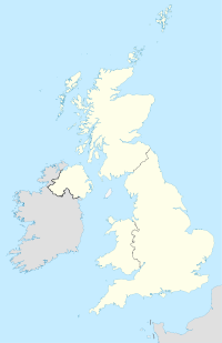
Stoke Lyne
- Stoke Lyne
-
Stoke Lyne est un village et une paroisse civile de l'Oxfordshire, en Angleterre, située à 6 kilomètres au nord de Bicester.
Sur les autres projets Wikimedia :
Wikimedia Foundation.
2010.
Contenu soumis à la licence CC-BY-SA. Source : Article Stoke Lyne de Wikipédia en français (auteurs)
Regardez d'autres dictionnaires:
Stoke — may refer to the following:Place namesUnited Kingdom*Stoke is one of the most common place names in the United Kingdom and in historical documents.Originally from the Old English stoc meaning place , it came to be used in two special senses, i) a … Wikipedia
Fringford — infobox UK place country = England static static image caption= latitude= 51.9532 longitude= 1.1225 official name =Fringford population = shire district= shire county= Oxfordshire metropolitan borough= metropolitan county = region=South East… … Wikipedia
Oxfordshire (UK Parliament constituency) — Oxfordshire Former County constituency for the House of Commons County Oxfordshire 1290 (1290)–1885 … Wikipedia
List of civil parishes in Oxfordshire — This is a list of civil parishes in the English ceremonial and non metropolitan county of Oxfordshire, England. =Cherwell= *Adderbury *Ambrosden *Ardley with Fewcott *Arncott *Banbury *Barford St. John and St. Michael *Begbroke *Bicester… … Wikipedia
Timeline of the Anglo-Saxon invasion of Britain — Constructing a chronology of the early Anglo Saxon period is highly complex, and the limitations of our source material place restrictions on just how accurate any chronology can be. Much of our dating of the period comes from Bede, writing in… … Wikipedia
Ceawlin of Wessex — Infobox Monarch caption=Ceawlin s name in the Anglo Saxon Chronicle name=Ceawlin title=King of Wessex reign=560 ndash;592 date of death=593 father=Cynric issue=CuthwineCeawlin (also spelled Ceaulin or Caelin ) (died c. 593) was a king of Wessex,… … Wikipedia
Æthelberht of Kent — Infobox Monarch imagesize=150px caption=Statue of Æthelberht. Interior of Rochester Cathedral name= Æthelberht title=King of Kent reign=c. 590 ndash; 616 date of death=616 father=Eormenric issue=EadbaldInfobox Monarch Saint feast day=February… … Wikipedia
Cherwell (district) — For other uses, see Cherwell (disambiguation). Cherwell District Non metropolitan district Cherwell shown within Oxfordshire … Wikipedia
Cropredy — Coordinates: 52°06′58″N 1°19′12″W / 52.116°N 1.320°W / 52.116; 1.320 … Wikipedia
Oxford West and Abingdon (UK Parliament constituency) — Oxford West and Abingdon County constituency for the House of Commons Boundary of Oxford West and Abingdon in … Wikipedia
 Angleterre
