Stoke Ferry
- Stoke Ferry
-
52° 34′ 00″ N 0° 31′ 00″ E / 52.5667, 0.5167

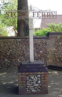
Panneau indiquant Stoke Ferry
Stoke Ferry est une paroisse civile du comté anglais de Norfolk, située à environ 9 kilomètres au sud-est de Downham Market.
Elle couvre une superficie de 9,15 km² et compte une population de 896 personnes, réparties en 358 ménages d'après le recensement de 2001 au Royaume-Uni[1].
Stoke Ferry relève de la circonscription de Lynn King's and West Norfolk.
Photographies de la ville
De nombreuses photos du village se trouve dans un recueil publié en 2007[2].
Références
- ↑ (en) www.norfolk.gov.uk/consumption/groups/public/documents/general_resources Population recensée avec les chiffres des ménages pour les zones urbaines et toutes les paroisses au Royaume-Uni, par l'Office for National Statistics & le Conseil du comté de Norfolk, en 2001 et consulté le 20 juin 2009
- ↑ Stoke Ferry Through Postcards Past, par Pat Holton and Janet Stocking, 2007, 52 pages, ISBN 095457687X
Wikimedia Foundation.
2010.
Contenu soumis à la licence CC-BY-SA. Source : Article Stoke Ferry de Wikipédia en français (auteurs)
Regardez d'autres dictionnaires:
Stoke Ferry — is a village in the English county of Norfolk, 6.5 miles south east of Downham Market. The village lies on the River Wissey which has also been known as the River Stoke.All Saints Church is no longer used for church services. It is now owned by… … Wikipedia
Stoke Ferry railway station — Infobox UK disused station name = Stoke Ferry caption = locale = Stoke Ferry borough = line = Downham and Stoke Ferry Railway manager = owner = London and North Eastern Railway platforms = 2 latitude = longitude = gridref = years = August 1 1882… … Wikipedia
Downham and Stoke Ferry Railway — Locale King s Lynn and West Norfolk Dates of operation 1882–1898 Successor Great Eastern Railway Track gauge 4 ft 8 1⁄2 in (1,435 mm) ( … Wikipedia
Stoke — may refer to the following:Place namesUnited Kingdom*Stoke is one of the most common place names in the United Kingdom and in historical documents.Originally from the Old English stoc meaning place , it came to be used in two special senses, i) a … Wikipedia
Middle Stoke Halt railway station — Middle Stoke Halt Location Place Middle Stoke Area Medway Grid reference … Wikipedia
Denver railway station (Great Eastern) — Denver Location Place Denver Area King s Lynn and West Norfolk Grid reference … Wikipedia
Northwold — Coordinates: 52°32′39″N 0°34′54″E / 52.544208°N 0.581589°E / 52.544208; 0.581589 … Wikipedia
Abbey and West Dereham railway station — Infobox UK disused station name = Abbey and West Dereham caption = locale = West Dereham borough = East Anglia line = Downham and Stoke Ferry Railway manager = owner = London and North Eastern Railway platforms = 2 latitude = longitude = gridref … Wikipedia
Shelford, Nottinghamshire — Shelford is a village in the Rushcliffe borough of Nottinghamshire. It is near Radcliffe on Trent. It has an old manor house (built on the site of Shelford Priory, a church and a [http://www.shelfordnurseriescaravanpark.co.uk camping site] . It… … Wikipedia
Fantôme de Cock Lane — Illustration de Cock Lane datant du XIXe siècle. Les apparitions ont lieu dans le bâtiment à trois étages sur la droite. Dessin datant de 1852. L’his … Wikipédia en Français

