Keynsham
- Keynsham
-
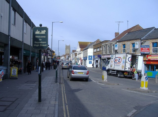
Keynsham (ˈkeɪnʃəm) est une ville du Somerset, en Angleterre. Située entre Bath et Bristol, elle comptait 15 533 habitants au moment du recensement de 2001.
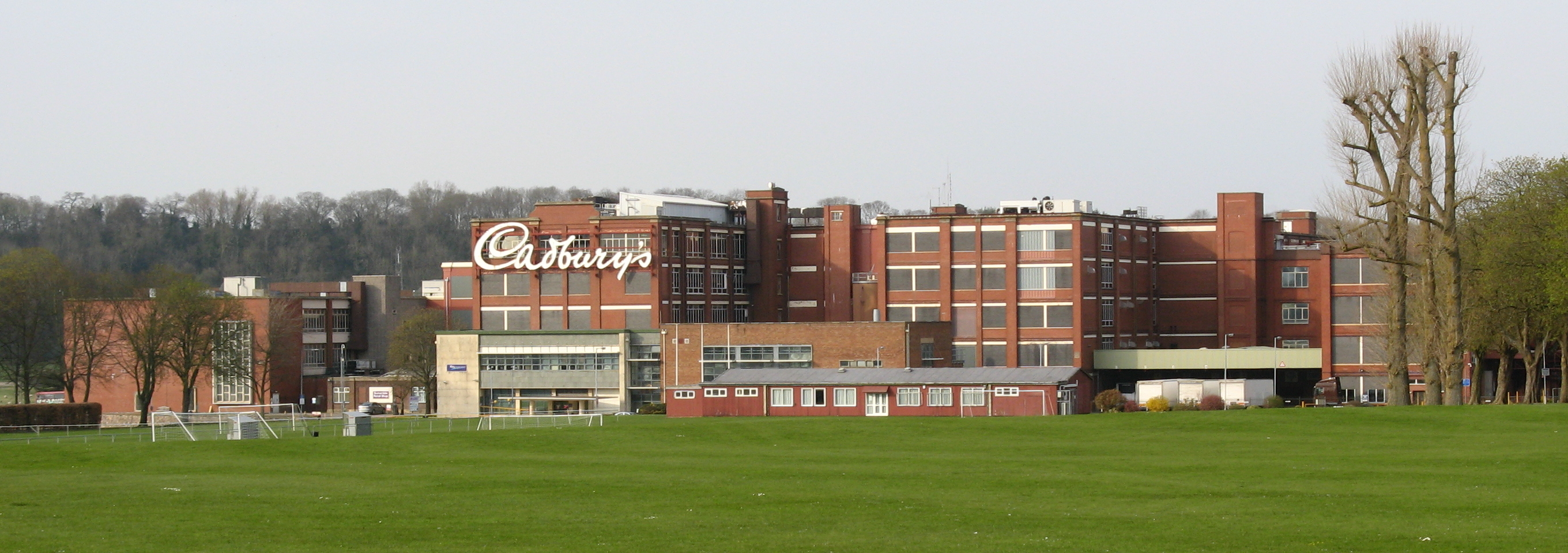
Elle apparaît sous le nom de Cainesham dans le Domesday Book. Elle abrite l'usine Cadbury de Somerdale, ouverte en 1935.
Sur les autres projets Wikimedia :
Wikimedia Foundation.
2010.
Contenu soumis à la licence CC-BY-SA. Source : Article Keynsham de Wikipédia en français (auteurs)
Regardez d'autres dictionnaires:
Keynsham — ist eine Stadt zwischen Bristol und Bath im Südwesten Englands. Er gehört zum Distrikt Bath and North East Somerset in der Region South West England und hat 15.500 Einwohner. Geschichte und Geografie Kenysham gehört traditionell zur Grafschaft… … Deutsch Wikipedia
Keynsham — infobox UK place country= England region= South West England latitude= 51.4135 longitude= 2.4968 official name= Keynsham population= 15,533 (2001 Census [ [http://neighbourhood.statistics.gov.uk/dissemination/LeadTableView.do?a=3 b=791539… … Wikipedia
Keynsham — Original name in latin Keynsham Name in other language Keynsham State code GB Continent/City Europe/London longitude 51.41387 latitude 2.4978 altitude 25 Population 15879 Date 2011 03 03 … Cities with a population over 1000 database
Keynsham Town F.C. — Keynsham Town Full name Keynsham Town Football Club Nickname(s) K s[1] Founded … Wikipedia
Keynsham Humpy Tumps — is a floristically rich acidic grassland site situated between the town of Keynsham, and the River Avon, southeast of Bristol, England.The site is on a south facing slope running alongside the Bristol to Bath railway line. It consists of open… … Wikipedia
Keynsham Lock — (gbmapping|ST658690) is situated on the River Avon at Keynsham, England.The lock opened in 1727. [cite book |last=Allsop |first=Niall |title=The Kennet Avon Canal |year=1987 |publisher=Millstream Book |location=Bath |id=ISBN 0 948975 15 6 ] Just… … Wikipedia
Keynsham railway station — Infobox UK station name = Keynsham code = KYN manager = First Great Western locale = Keynsham borough = Bath and North East Somerset usage0405 = 0.169 usage0506 = 0.188 usage0607 = 0.210 platforms = 2 start = 1840Keynsham railway station serves… … Wikipedia
Keynsham (album) — Infobox Album | Name = Keynsham Type =studio Artist = Bonzo Dog Doo Dah Band Cover size = Caption = Released = August, 1969 Recorded = Soho, London Genre = Rock Length = Label = Liberty LBS 83290 (also Sunset SLS 50375) Producer = Neil Innes,… … Wikipedia
Chewton Keynsham — Coordinates: 51°23′44″N 2°29′58″W / 51.3955°N 2.4995°W / 51.3955; 2.4995 … Wikipedia
Bath and North East Somerset — Infobox Settlement official name = Bath and North East Somerset nickname = BANES or B NES settlement type = unitary authority motto = imagesize = image caption = flag size = image seal size = image shield = shield size = image blank emblem =… … Wikipedia

 Angleterre
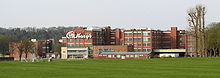 L'usine de Somerdale.
 Catégorie :