Haroldswick
- Haroldswick
-
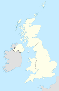
Haroldswick est une ville écossaise située aux Shetland sur l'île d'Unst. C'est l'endroit habité le plus au nord du Royaume-Uni.
Wikimedia Foundation.
2010.
Contenu soumis à la licence CC-BY-SA. Source : Article Haroldswick de Wikipédia en français (auteurs)
Regardez d'autres dictionnaires:
Haroldswick — Infobox UK place official name= Haroldswick country= Scotland population= os grid reference= latitude= 60.78 longitude= 0.83 post town= SHETLAND postcode area= ZE postcode district= ZE2 dial code= 01595 constituency westminster= Orkney and… … Wikipedia
North Isles — Shetland Islands with North Isles highlighted in red Huney from Unst, and some other North Isles … Wikipedia
Shetland — For other uses, see Shetland (disambiguation). Shetland Sealtainn … Wikipedia
Unst — Infobox Scottish island | GridReference=HP600091 celtic name= norse name=Ornyst meaning of name= Possibly of Pictish origin or Old Norse for home of the eagle area=120.68 km² area rank=14 highest elevation= Saxa Vord 284 m Population=720… … Wikipedia
Skaw — For the Skaw municipality of Denmark, see Skagen; there is also a Skaw on Whalsay. The road to Skaw Skaw is a tiny settlement on the Shetland island of Unst. It is located north of Haroldswick on a peninsula in the northeast corner of the island … Wikipedia
List of state schools in Scotland/Council Areas S-W (excluding cities) — The following is a partial list of currently operating state schools in the unitary council areas of Scottish Borders, Shetland Islands, South Ayrshire, South Lanarkshire, Stirling, West Dunbartonshire, West Lothian and Western Isles in Scotland … Wikipedia
Baltasound — Infobox UK place official name= Baltasound country= Scotland population= os grid reference= latitude= 60.76 longitude= 0.86 post town= SHETLAND postcode area= ZE postcode district= ZE2 dial code= 01957 constituency westminster= Orkney and… … Wikipedia
Unst — Muness Castle auf Unst Gewässer Nordsee Inselgruppe … Deutsch Wikipedia
Unst Bus Shelter — im Juli 2004 Karte von Yell, Unst … Deutsch Wikipedia
Unst — UNST, a parish and island, in the county of Orkney and Shetland, 43 miles (N. by E.) from Lerwick; containing, with the island of Uya, 2831 inhabitants. The island of Unst, of which this parish mainly consists, is the most northern part of the … A Topographical dictionary of Scotland

 Écosse