Unst

Unst
Unst
Géographie
Pays Drapeau : Royaume-Uni Royaume-Uni
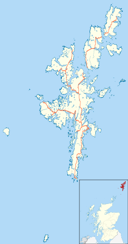
Archipel Shetland
Localisation Océan Atlantique
Coordonnées 60° 45′ 00″ N 0° 53′ 00″ W / 60.75, -0.88333360° 45′ 00″ N 0° 53′ 00″ W / 60.75, -0.883333
Superficie 120,68 km2
Point culminant Saxa Vord (284 m)
Géologie Île continentale
Administration
Drapeau : Royaume-Uni Royaume-Uni
Nation constitutive Écosse
Council Area Shetland
Démographie
Population 720 hab. (2001)
Densité 5,97 hab./km2
Plus grande ville Baltasound
Autres informations
Découverte Préhistoire
Fuseau horaire UTC+0

Géolocalisation sur la carte : Shetland

(Voir situation sur carte : Shetland)
Unst
Unst

Géolocalisation sur la carte : Royaume-Uni

(Voir situation sur carte : Royaume-Uni)
Unst
Unst
Îles du Royaume-Uni

Unst est une des îles du Nord (North Isles) de l'archipel des Shetland, au nord-ouest de l'Écosse. C'est l'île habitée la plus septentrionale des Îles Britanniques et la troisième plus grande île des Shetland après Mainland et Yell avec une superficie de 120,68 km².

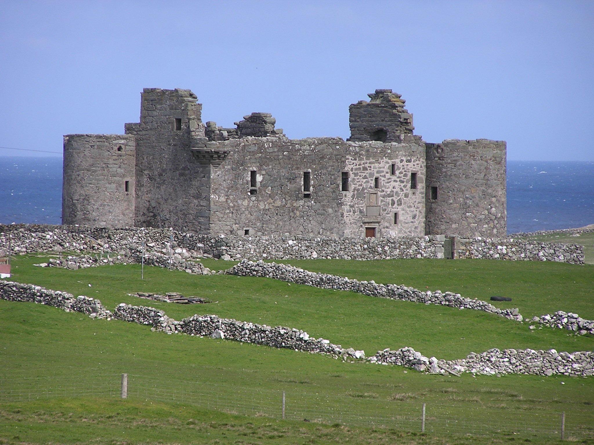
L'île est largement recouverte d'herbage avec une côte de falaises. Le village principal est Baltasound, port de pêche qui abrite également une brasserie et un aéroport. Parmi les autres hameaux, Uyeasound, où se trouve Greenwell's Booth un entrepôt de l'époque hanséatique et Muness Castle, (construite en 1598 et pillé par des pirates en 1627) et Haroldswick avec un musée maritime.
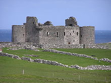
Muness Castle,

Référence

Liens externes

Sur les autres projets Wikimedia :


Wikimedia Foundation. 2010.

Contenu soumis à la licence CC-BY-SA. Source : Article Unst de Wikipédia en français (auteurs)

Игры ⚽ Нужно решить контрольную?

Regardez d'autres dictionnaires:

  • Unst — Playa en Sandwick, Unst. Localización País Escocia …   Wikipedia Español

  • Unst — Muness Castle auf Unst Gewässer Nordsee Inselgruppe …   Deutsch Wikipedia

  • Unst —    UNST, a parish and island, in the county of Orkney and Shetland, 43 miles (N. by E.) from Lerwick; containing, with the island of Uya, 2831 inhabitants. The island of Unst, of which this parish mainly consists, is the most northern part of the …   A Topographical dictionary of Scotland

  • Unst — (spr. Onst), nördlichste Insel aus der Gruppe der Shetländischen, von Yell durch den Blomelsund getrennt; hat 2 QM., ist gebirgig, bringt viel u. gute Bruchsteine; in den guten Häfen legen die Grönlandsfahrer oft an; 2300 Ew. In der Mitte der… …   Pierer's Universal-Lexikon

  • Unst — (spr. önnst), die nördlichste der Shetlandinseln (s. d.), mit meteorologischer Station, Strumpfwirkerei, Fischerei und (1901) 1940 Einw …   Meyers Großes Konversations-Lexikon

  • Unst — (spr. önnst), die nördlichste der Shetlandinseln, 126 qkm, (1901) 1946 E …   Kleines Konversations-Lexikon

  • Unst —   [ʌnst], die nördlichste der Shetlandinseln, Schottland, 98 km2, 1 000 Einwohner.   …   Universal-Lexikon

  • Unst — Infobox Scottish island | GridReference=HP600091 celtic name= norse name=Ornyst meaning of name= Possibly of Pictish origin or Old Norse for home of the eagle area=120.68 km² area rank=14 highest elevation= Saxa Vord 284 m Population=720… …   Wikipedia

  • Unst — Sp Ánstas Ap Unst L s. Šetlande, D. Britanija (Škotija) …   Pasaulio vietovardžiai. Internetinė duomenų bazė

  • Unst Bus Shelter — im Juli 2004 Karte von Yell, Unst …   Deutsch Wikipedia

Share the article and excerpts

Direct link
Do a right-click on the link above
and select “Copy Link”