Ghaziabad

Ghaziabad
Ghaziabad

Ajouter une image

Administration
Pays Drapeau d'Inde Inde
État et territoire Uttar Pradesh
District Ghaziabad
Démographie
Population 968 521 hab. (2001)
Géographie
Coordonnées 28° 40′ 24″ N 77° 26′ 11″ E / 28.6733333, 77.436388928° 40′ 24″ Nord
       77° 26′ 11″ Est
/ 28.6733333, 77.4363889
  
Fuseau horaire IST
(UTC+5.30)
Index postal 201 xxx

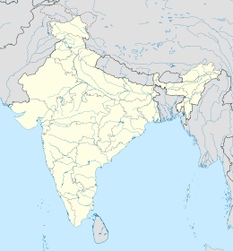
Géolocalisation sur la carte : Inde

Voir la carte administrative
Ghaziabad

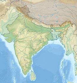
Géolocalisation sur la carte : Inde

Voir la carte topographique
Ghaziabad

Ghaziabad (hindî : ग़ाज़ियाबाद) est une ville de l'État de l'Uttar Pradesh en Inde.


Sommaire

Géographie

Ghaziabad est située à 19 km à l'est de New Delhi.

Économie

Ghaziabad est l'une des villes les plus industrialisées de l'Uttar Pradesh, produisant, entre autres, des trains, des moteurs diesel, des bicyclettes, des tubes cathodiques, des tapisseries, de la verrerie, des poteries, de l'huile végétale, des peintures, des vernis, des pièces automobiles, de l'alcool...

De grandes entreprises y sont implantées parmi lesquelles Shriram Pistons, Unichem, Dabur, International Tobacco, Bhushan Steels, Rathi Alloys, Crophealth Products Pvt. Ltd., Allied Nippon Ltd, Samtel Color.

Ghaziabad compte également le plus grand nombre de centres commerciaux après la ville de Bangalore.

Chaque jour pas moins d'une centaine de trains transitent par la gare de Ghaziabad.

Histoire

Lieux et monuments

Voir aussi

Lien externe


Wikimedia Foundation. 2010.

Contenu soumis à la licence CC-BY-SA. Source : Article Ghaziabad de Wikipédia en français (auteurs)

Игры ⚽ Поможем сделать НИР

Regardez d'autres dictionnaires:

  • Ghaziabad — may refer to Ghaziabad district, India, a district in the Indian state of Uttar Pradesh Ghaziabad, India, is an industrial city, headquarters of the district Ghaziabad, Karachi, a neighborhood of Karachi, Sindh, Pakistan Ghaziabad District, Kunar …   Wikipedia

  • Ghaziabad — Ghaziabad …   Deutsch Wikipedia

  • Ghaziabad — (Hindi: ग़ाज़ियाबाद, urdu: غازی آباد) es una ciudad industrial de la India situada en el estado de Uttar Pradesh, a orillas del río Hindon, al norte del país. Está a 19 km al este de Delhi y 46 km al suroeste de Meerut. La ciudad alberga la sede… …   Wikipedia Español

  • Ghaziabad —   [ z ], Stadt im Bundesstaat Uttar Pradesh, Nordindien, östlich von Delhi am Gangeskanal, (1991) 454 000 Einwohner (1981: 271 700 Einwohner); Ölmühlen, Konserven , Metallindustrie, staatliche Elektronikfabrik …   Universal-Lexikon

  • Ghaziabad — Gha·zi·a·bad (gäʹzē ə bäd ) A city of north central India northeast of New Delhi. An agricultural market, the city was the scene of fighting during the Indian Mutiny (1857). Population: 454,156. * * * ▪ India formerly  Ghaziuddinnagar        city …   Universalium

  • Ghaziabad — 1 Admin ASC 2 Code Orig. name Ghāzīābād Country and Admin Code AF.34.7053960 AF 2 Admin ASC 2 Code Orig. name Ghāziābād Country and Admin Code IN.36.1271310 IN …   World countries Adminstrative division ASC I-II

  • Ghaziabad — Original name in latin Ghzibd Name in other language Gaziabad, Ghaziabad, Ghazibad, Ghzibd, Газиабад State code IN Continent/City Asia/Kolkata longitude 28.66249 latitude 77.43777 altitude 215 Population 1199191 Date 2012 10 06 …   Cities with a population over 1000 database

  • Ghaziabad district — is a district of Uttar Pradesh state in northern India. The town of Ghaziabad is the administrative headquarters of the district.Ghaziabad district is bounded on the northwest by Baghpat District, on the north by Meerut District, on the east by… …   Wikipedia

  • Ghaziabad (Karachi) — Ghaziabad is one of the neighbourhoods of Orangi Town in Karachi, Sindh, Pakistan. [ [http://www.karachicity.gov.pk/town/index.asp?txtTown=Orangi Orangi Town Government of Karachi] ] There are several ethnic groups in Orangi Town including Urdu… …   Wikipedia

  • Ghaziabad district, Kunar Province — The Ghaziabad district is situated in the western part of Kunar Province, Afghanistan and was part of Nurgal district. It borders with Nangarhar Province to the west, Chapa Dara district to the north, Chawkay district to the east and Nurgal… …   Wikipedia

Share the article and excerpts

Direct link
Do a right-click on the link above
and select “Copy Link”