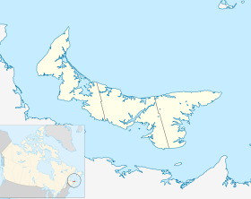
Campbells Cove
Contenu soumis à la licence CC-BY-SA. Source : Article Campbells Cove de Wikipédia en français (auteurs)
Regardez d'autres dictionnaires:
Campbells Cove Provincial Park — is a provincial park in Prince Edward Island, Canada … Wikipedia
Port au Port Peninsula — The Port au Port Peninsula is a peninsula in the Canadian province of Newfoundland and Labrador. Roughly triangular in shape, it is located on the west coast of the island of Newfoundland.GeographyThe peninsula extends into the Gulf of St.… … Wikipedia
Geography of Port Phillip — Port Phillip, or more commonly, Port Phillip Bay, is a large bay in southern Victoria, Australia, 1,930 km² (476,900 acres) in area, with a coastline length of 264 km (164 miles). The bay is extremely shallow for its size, but mostly navigable.… … Wikipedia
Liste des localités de l'Île-du-Prince-Édouard — Voici une liste des villes, villages et hameaux de la province canadienne de l Île du Prince Édouard. Voir aussi la liste des municipalités de l Île du Prince Édouard. Sommaire 1 Liste 1.1 1, 2, ... 1.2 A 1.3 … Wikipédia en Français
Beaches in Port Phillip — Port Phillip is a bay in central Victoria. It hosts many beaches, most of which are flat, shallow and long, with very small breaks making swimming quite safe. This attracts many tourists, mostly families, to the beaches of Port Phillip during the … Wikipedia
Circular Quay — heute Der Circular Quay befindet sich am nördlichen Ende des Stadtzentrums von Sydney, New South Wales, Australien. Beim Circular Quay handelt es sich um Straßen und angrenzende Gebäude welche rings um den Sydney Cove liegen. Das östliche Ende… … Deutsch Wikipedia
List of parks in Prince Edward Island — A list of parks in Prince Edward Island.National Parks and National Historic Sites* Prince Edward Island National Park * Port La Joye / Fort Amherst * Province House * ArdgowanProvincial ParksCamping*Brudenell River Provincial Park (Open May 22… … Wikipedia
Eastern Kings — Administration Pays Canada Province … Wikipédia en Français
List of localities in Victoria (Australia) — Map of Local Government Areas in Victoria This is a list of locality names and populated place names in the state of Victoria, Australia, outside the Melbourne metropolitan area. It is organised by region from the south west of the state to the… … Wikipedia
Список телесериалов по наименованию — Содержание 1 Русскоязычные 2 На других языках 3 0 9 4 Латиница … Википедия
 Canada
 Île-du-Prince-Édouard