Bonshaw
- Bonshaw
-
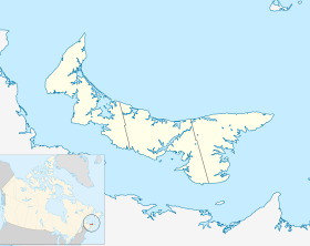
Bonshaw est une petite communauté canadienne rurale et agricole au centre de l'Île-du-Prince-Édouard, située sur la rive sud du comté de Queens longeant le détroit de Northumberland.
La communauté est située dans la vallée de la rivière West, entouré de petites collines, familièrement connu sous le nom de "Bonshaw Hills". La section d'eau douce de la rivière qui passe dans la communauté offre la meilleure pêche à la truite de l'île.
Le parc provincial Bonshaw est à la limite sud de la communauté. Il y a plusieurs pistes pittoresques et renommées pour les marcheurs et les cyclistes.
Liens externes
Wikimedia Foundation.
2010.
Contenu soumis à la licence CC-BY-SA. Source : Article Bonshaw de Wikipédia en français (auteurs)
Regardez d'autres dictionnaires:
Bonshaw — may refer to: *Bonshaw, New South Wales, a town in Australia. *Bonshaw, Prince Edward Island, a town on Prince Edward Island, Canada … Wikipedia
Bonshaw (Île-du-Prince-Édouard) — Bonshaw Administration Pays Canada Province … Wikipédia en Français
Bonshaw, New South Wales — Bonshaw is a small town in New South Wales, Australia 783 km north of Sydney. It is located near the northern border of the State close to Texas, Queensland, from which it is separated by the Dumaresq River which forms the border between the… … Wikipedia
Bonshaw, Prince Edward Island — Bonshaw is a small Canadian rural farming community in central Prince Edward Island, situated on the province s South Shore along the Northumberland Strait.The community is located in the valley of the West River, surrounded by low rolling hills … Wikipedia
Bonshaw Provincial Park — is a provincial park in Prince Edward Island, Canada … Wikipedia
Barony of Bonshaw — The Barony of Bonshaw was in the old feudal Baillerie of Cunninghame, near Stewarton in what is now North Ayrshire, Scotland. The History of Bonshaw The Irvine s and Boyd sWilliam Irvine (c.1298) (also known as William de Irwin) was a soldier. He … Wikipedia
Chapeltoun — Coordinates: 55°39′56″N 4°33′17″W / 55.66557°N 4.55484°W / 55.66557; 4.55484 … Wikipedia
Bruxner Highway — bei Drake. Der … Deutsch Wikipedia
Moot hill — A moot hill or mons placiti (statute hill)[1] is a hill or mound historically used as an assembly or meeting place. In early medieval Britain, such hills were used for moots , meetings of local people to settle local business. Among other things … Wikipedia
Comté de Queens (Île-du-Prince-Édouard) — Pour les articles homonymes, voir Comté de Queens. 46°17′N 63°15′W / … Wikipédia en Français
 Canada
 Île-du-Prince-Édouard