Burnt Point
Contenu soumis à la licence CC-BY-SA. Source : Article Burnt Point de Wikipédia en français (auteurs)
Regardez d'autres dictionnaires:
Burnt Point, Newfoundland and Labrador — Burnt Point a small Canadian fishing village in the province of Newfoundland and Labrador.It is located on the north side of Conception Bay on the Bay de Verde Peninsula of the island of Newfoundland.GeographyThe community of Burnt Point for the… … Wikipedia
Burnt Church — (en micmac: Eskɨnuopitijk [Francis Smith], Esgenoôpetitj [Pacifique]) est à la fois un village et une première nation micmacque, la Première nation de Burnt Church, de la province canadienne du Nouveau Brunswick. Elle possède trois réserve… … Wikipédia en Français
Burnt Church 14 — Administration Pays Canada Province … Wikipédia en Français
Burnt River (Oregon) — Coordinates: 44°21′54″N 117°13′34″W / 44.365°N 117.22611°W / 44.365; 117.22611 … Wikipedia
Point of no return — For other uses, see Point of no return (disambiguation). Crossing the Rubicon redirects here. For other uses, see Crossing the Rubicon (disambiguation). The point of no return is the point beyond which one must continue on his or her current… … Wikipedia
Operation Burnt Frost — Break up of USA 193 following interception Objective Destruction of non functioning satellite USA 193 Date 4 January – 20 February 20 … Wikipedia
Church Point, Louisiana — Coordinates: 30°24′17″N 92°13′01″W / 30.40472°N 92.21694°W / 30.40472; 92.21694 … Wikipedia
Dewolf Point State Park — is a small park on Wellesley Island in the St. Lawrence River. Contents 1 Location in the State of New York 2 Features 2.1 Opening season 2.2 Facilities … Wikipedia
Montauk Point State Park — Montauk Point Light Montauk Point State Park is located in the hamlet of Montauk, at the eastern tip of Long Island in the Town of East Hampton, Suffolk County, New York. Montauk Point is the easternmost extremity of the South Fork of Long Island … Wikipedia
Crown Point State Historic Site — is the site of a former military stronghold at the south end of the wider part of Lake Champlain. The location is in Essex County, New York, USA. The site is on a peninsula in the town of Crown Point, New York. Crown Point is the location of the… … Wikipedia
 Canada
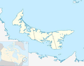
 Île-du-Prince-Édouard