Buhla
- Buhla
-
Buhla est une commune allemande située dans l'arrondissement d'Eichsfeld en Thuringe.
Géographie

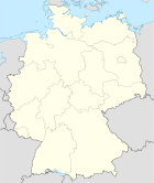
Situation de Buhla dans l'
arrondissement
Buhla est située dans l'est de l'arrondissement à quelques kilomètres au nord-est de Leinefelde. Elle est composée des deux villages de Buhla et Ascherode.
Histoire
La commune a appartenu à l'ancien arrondissement de Grafshaft Hohenstein jusqu'en 1945 et ensuite à celui de Worbis jusqu'en 1990.
Démographie
Évolution démographique
| 1910 |
1925 |
1933 |
1939 |
1995 |
2000 |
2004 |
2010 |
| 864[1] |
787[2] |
805[2] |
741[2] |
677 |
672 |
616 |
554[3] |
Notes et références
Sur les autres projets Wikimedia :
Wikimedia Foundation.
2010.
Contenu soumis à la licence CC-BY-SA. Source : Article Buhla de Wikipédia en français (auteurs)
Regardez d'autres dictionnaires:
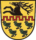
Buhla — Wappen Deutschlandkarte … Deutsch Wikipedia
Buhla — Infobox Ort in Deutschland image photo = Wappen = Wappen Buhla.png lat deg = 51 |lat min = 26 |lat sec = 24 lon deg = 10 |lon min = 29 |lon sec = 24 Lageplan = Bundesland = Thüringen Landkreis = Eichsfeld Verwaltungsgemeinschaft = Eichsfeld… … Wikipedia
Buhla — Original name in latin Buhla Name in other language Buhla State code DE Continent/City Europe/Berlin longitude 51.43333 latitude 10.43333 altitude 423 Population 617 Date 2011 04 25 … Cities with a population over 1000 database
Konica Autoreflex — The Auto Reflex and Autoreflex is a series of 35mm SLR cameras made by Konica from 1965. All these models have the Konica AR bayonet. Konica Auto Reflex, Autorex and Revue Auto Reflex The Konica Auto Reflex of 1965 was the world s first… … Wikipedia
Liste der Burgen und Schlösser in Thüringen — Auf dem Gebiet des deutschen Bundeslandes Thüringen befindet sich eine Vielzahl von Schlössern und Burgen. Diese zum Teil auf eine 1000 jährige Geschichte zurückblickenden Bauten waren Schauplatz historischer Ereignisse, Wirkungsstätte bekannter… … Deutsch Wikipedia
List of castles in Thuringia — Numerous castles are found in the German state of Thuringia. These buildings, some of which have a history of over 1000 years, were the setting of historical events, domains of famous personalities and are still imposing buildings to this day.… … Wikipedia
Bleicheröder Berge — p1f1dep2p5 Bleicheröder Berge Höchster Gipfel Ziegenrück (460,8 m ü. NN) Lage Landkreise Nordhausen und Eichsfeld,(Thüringen) … Deutsch Wikipedia
Hasenburg (Eichsfeld) — Hasenburg Die Hasenburg (1940) Alternativname(n): Asenberg, Asenburg … Deutsch Wikipedia
Ohmgebirge — p1dep2p5 Ohmgebirge Nordausläufer des Ohmgebirges direkt südlich von Holungen Höchster Gipfel Birken … Deutsch Wikipedia
Liste von Bergen und Erhebungen in Thüringen — Großer Beerberg (Thüringer Wald) … Deutsch Wikipedia
 Allemagne


